Alert Day Declared for Kentucky Friday With Low Tornado Risk and 65 MPH Damaging Wind Threat as Isolated Cells Expected Between 2 PM and 9 PM Across the State
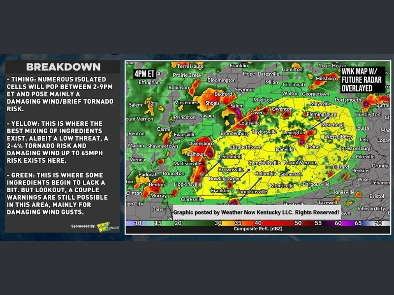
LOUISVILLE, KY — Weather Now Kentucky has declared an Alert Day for Friday as a low end but real tornado risk and damaging wind threat develops across the state between 2:00 PM and 9:00 PM Eastern Time. A brief tornado or two alongside damaging winds up to 65 miles per hour are possible in a low end fashion as numerous isolated cells pop across Kentucky during the afternoon and evening hours, with the yellow zone carrying the greatest concentration of favorable ingredients for the most significant storm hazards of the day.
Yellow Zone Carries 2 to 4 Percent Tornado Risk and 65 MPH Wind Threat Across Central Kentucky
The yellow zone on Friday’s forecast map represents the area where the best mixing of atmospheric ingredients exists for storm development, carrying a 2 to 4 percent tornado risk alongside a damaging wind threat reaching up to 65 miles per hour. This zone covers a broad corridor across central and western Kentucky encompassing Louisville, Lexington, Elizabethtown, Owensboro, Bowling Green, and surrounding communities where conditions are most favorable for the brief tornado and damaging wind producing storms expected during the 2 to 9 PM window.
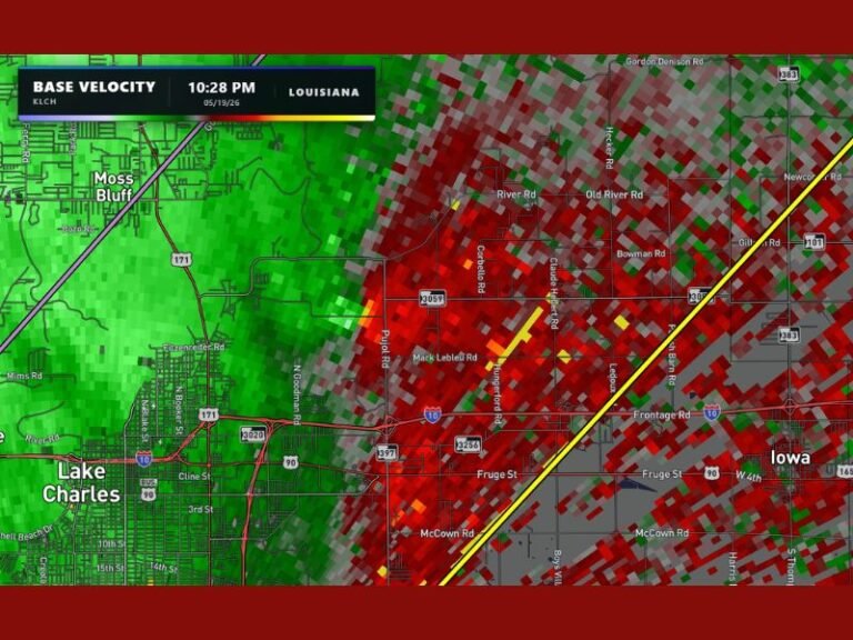
Future radar overlay imagery at 4:00 PM shows active storm returns already developing across the yellow zone, confirming the expected afternoon convective initiation across the region.
Green Zone Still Faces Possible Warnings Mainly for Damaging Wind Gusts
Communities falling within the green zone on Friday’s outlook are not entirely in the clear, as a couple of severe thunderstorm warnings remain possible across this area primarily driven by damaging wind gusts. While the green zone represents an area where some atmospheric ingredients begin to lack compared to the yellow zone, the residual wind gust threat means residents across these communities should remain weather aware through the same 2 to 9 PM window as storm cells move through the region.
The green zone extends across portions of southern and eastern Kentucky, including communities toward the Tennessee border and into the southeastern mountain counties where damaging wind gusts represent the primary Friday storm hazard.
Residents Urged to Monitor Conditions Between 2 PM and 9 PM Friday
All Kentucky residents across both the yellow and green zones are encouraged to remain actively weather aware throughout the Friday afternoon and evening storm window. The isolated and scattered nature of Friday’s storm cells means some locations will see significant activity while others experience nothing, making continuous monitoring of updated radar and warning information essential for all communities across the state through the 9:00 PM end of the primary storm window.
For continuing coverage of tornado risks and severe weather alerts across the United States, visit SaludaStandard-Sentinel.com.