Tornado Risk Rapidly Decreasing Across Arkansas and Missouri by 10 PM With Hail and Heavy Rain Remaining the Only Active Threat Along I-40 Toward Memphis
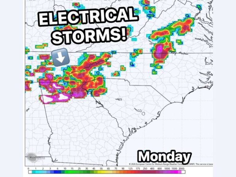
ARKANSAS — A 10 p.m. update confirms that the tornado risk across Arkansas and southern Missouri is quickly decreasing as the evening progresses. The early potential for supercell development turned out to be a significant underperformance, with a few attempts at organization never coming together into a meaningful severe weather threat during the afternoon and evening hours.
Supercell Potential Failed to Materialize Despite Earlier Expectations
Forecasters had anticipated radar to be lighting up with overnight storm activity by this point, but activity has remained surprisingly limited across the region. The early supercell potential was a complete miss, marking one of the more unexpected outcomes seen on what had been flagged as a potential significant severe weather day across the area.
Hail and Heavy Rain Remain the Only Active Threats Tonight
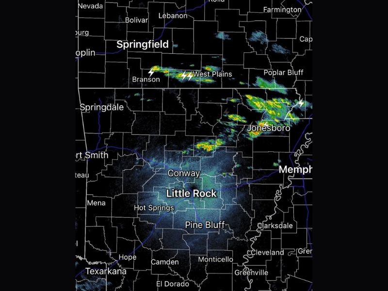
While the tornado threat is fading, storms continuing to develop later tonight still carry a risk for hail and heavy rain, particularly along the Interstate 40 corridor toward Memphis. Radar shows active storm cells near Branson, West Plains, Poplar Bluff, and Jonesboro, with lightning activity confirmed across these areas as the cold front continues pushing southward through the region.
Cold Front Pushes South and Ends Warm Humid Air Supporting Tornadoes
The advancing cold front is continuing to push southward tonight, steadily cutting off the warm and humid air mass that would be needed to support further tornado development. As the front progresses through Arkansas and Missouri overnight, atmospheric instability will continue to drop, effectively ending the organized severe weather threat across both states before morning.
Areas of Rain and Storms Possible Again by Wednesday Sunrise
Based on the latest forecast data, areas of rain and a few storms may redevelop across the region by Wednesday sunrise as moisture lingers behind the departing front. Residents across Arkansas, southern Missouri, and the Memphis corridor are advised to remain weather aware heading into Wednesday morning. For continuing coverage of severe weather events across the United States, visit SaludaStandard-Sentinel.com.