Violent Tornado Outbreak Threatens Central US Sunday and Monday as SPC Issues Rare Level 4 Moderate Risk With Hatched Zones Signaling Intense, Long-Track Twisters
NORMAN, OKLAHOMA — A powerful and locked weather pattern is setting the stage for one of the most significant severe weather outbreaks of the season across the central United States, with the Storm Prediction Center issuing elevated risk outlooks for both Sunday, April 26, and Monday, April 27. Meteorologists are warning of large, potentially violent tornadoes on both days, urging millions of residents across the region to prepare immediately.
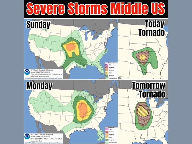
Sunday Outlook Flags Violent Tornado Potential
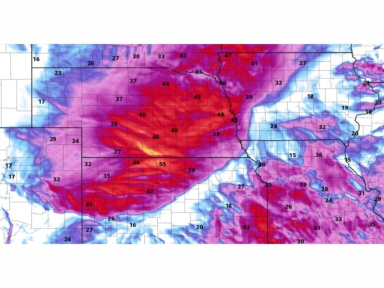
The SPC’s Day 1 Categorical Outlook, issued at 0532Z on April 26 and valid through 1200Z Monday, places a Level 4 Moderate Risk over a broad swath of the central Plains and Mississippi Valley. Forecasters Broyles and Moore have highlighted an orange-shaded core zone within the risk area, indicating atmospheric conditions are highly favorable for strong, long-track tornadoes capable of widespread damage.
The tornado probability maps show a hatched zone for Sunday — a rare designation signaling high confidence in violent tornadoes rated EF2 or stronger. Supercells forming within this environment are expected to produce prolonged, intense rotation, placing residents inside the hatched area at the most serious risk of the day.
Monday’s Threat Escalates Further
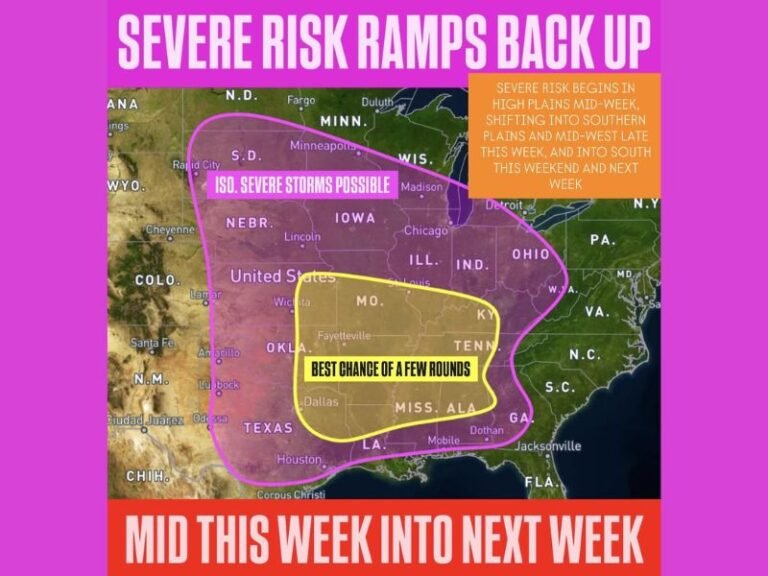
The SPC’s Day 2 Outlook, valid from 1200Z Monday through 1200Z Tuesday and issued by forecaster Kerr, shows the risk area shifting eastward with the core threat centered over Illinois and surrounding states. Enhanced and Moderate risk zones stretch across a wide multi-state corridor, and a new Level 2 hatched zone has been introduced on Monday’s tornado probability panel.
This makes the overall event a multi-day, multi-state emergency-level weather situation, with the combined footprint covering millions of residents from the southern Plains to the Great Lakes region.
Locked Pattern Extends the Danger Window
Meteorologists warn that the weather pattern remains locked in place, allowing multiple rounds of supercells to develop across the same high-risk corridors on both days. Southern and eastern parts of the country are expected to stay quiet during this period.
Residents are strongly urged to have multiple ways to receive warnings, identify a sturdy shelter location, and monitor their local National Weather Service office closely throughout the weekend. For continuing coverage of major weather events across the nation, visit SaludaStandard-Sentinel.com.