Ohio Second Wave of Severe Storms Expected Wednesday Afternoon With Tornado Threat and Damaging Winds From Toledo to Akron Between 2PM and 8PM
OHIO — A second wave of severe thunderstorms is expected to redevelop across a large portion of Ohio on Wednesday afternoon, April 15, 2026, with the greatest threat period running from 2:00 PM through 8:00 PM and the first four hours of that window carrying the highest risk. Forecasters at WTOL 11 issued a Weather Impact Alert for the region, warning that strong gusty winds and isolated tornadoes are both possible as storm lines redevelop following a morning lull in activity.
A veteran meteorologist with 15 years of experience at WTOL 11 described this as by far the busiest start to a spring severe weather season ever covered, underscoring the exceptional and relentless nature of the ongoing outbreak affecting the region.
Second Wave Expected to Redevelop This Afternoon
After morning showers and thunderstorms fade through midday, the atmosphere is forecast to recover and destabilize sufficiently for a new round of severe storms to fire during the early afternoon hours. This second wave scenario is particularly dangerous because residents may let their guard down during the quieter morning hours, only to be caught off guard when conditions rapidly deteriorate again later in the day.
The main timing window of 2:00 PM to 8:00 PM covers the peak heating hours of the afternoon, which combined with an unstable atmosphere creates ideal fuel for storm development across the region.
Greatest Severe Risk Concentrated in Central and Northern Ohio
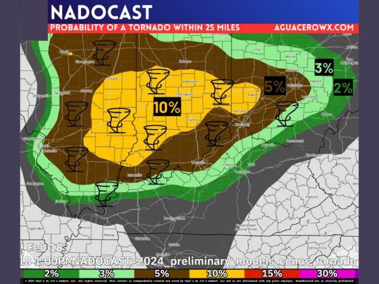
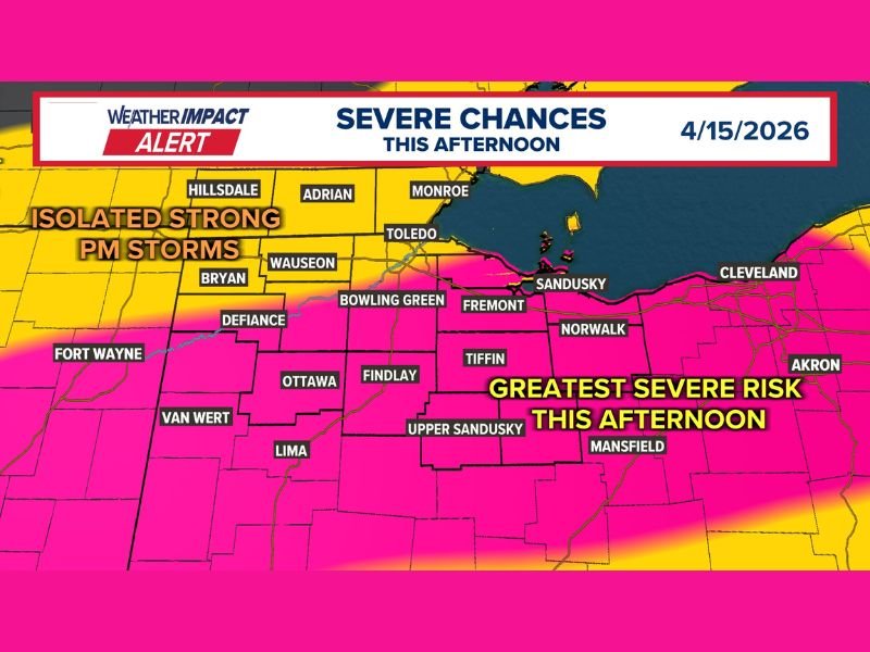
Forecast graphics from WTOL 11 showed the greatest severe weather risk concentrated across central and northern Ohio, with communities including Toledo, Fremont, Sandusky, Norwalk, Tiffin, Findlay, Upper Sandusky, Mansfield, and Akron all highlighted within the highest-risk zone. The risk gradient extended westward into Indiana near Fort Wayne and covered additional Ohio communities including Lima, Van Wert, Defiance, Ottawa, Bryan, Wauseon, Bowling Green, and Adrian.
Areas closer to Lake Erie along the northern Ohio shoreline were also included in the elevated risk area, meaning the threat is widespread rather than isolated to any single corridor of the state.
Tornadoes and Damaging Winds Both Possible
The primary hazard from Wednesday afternoon’s storm wave will be strong and gusty winds capable of downing trees, snapping power lines, and causing structural damage across affected communities. However, forecasters explicitly noted that tornadoes will also be possible, particularly with smaller segments of storm lines that attempt to develop and organize during the afternoon hours.
Residents across the warned regions should have multiple ways to receive emergency alerts activated well before the 2:00 PM threat window opens. Do not wait for sirens — a weather radio, smartphone alert, or reliable weather app should be your first line of warning. If a tornado warning is issued for your county, move immediately to the lowest interior room of a sturdy structure and stay away from all windows until the threat clears.
Are you preparing for Wednesday afternoon’s severe weather threat across Ohio? Share your updates and stay connected with our continuing storm coverage at SaludaStandard-Sentinel.com.