Iowa Storm Chasers Document 5 Tornadoes Including Dangerous HP Twisters and Rope Tornado Near Onslow
IOWA — A dramatic storm chase concluded Tuesday with five tornadoes documented across Iowa, including four highly dangerous high-precipitation tornadoes and a visually striking rope tornado near Onslow that developed just as chasers arrived on scene. The chase produced some of the most intense close-range tornado encounters of the season, with one twister described as looping back toward the chase crew in a hair-raising moment.
The documented tornadoes added to a significant severe weather outbreak that impacted portions of the state throughout the day, drawing experienced storm chasers into the field to track and report on rapidly developing supercell activity.
Four Dangerous HP Tornadoes Documented
The first four tornadoes encountered during the chase were classified as high-precipitation tornadoes — among the most hazardous type for both chasers and the general public. HP tornadoes are embedded within heavy rain and are extremely difficult to see, making them particularly dangerous as they can strike with little to no visual warning for residents in their path.
One of the four HP tornadoes exhibited an unusual and alarming behavior, looping or carouseling back in the direction of the chase crew, creating an extremely dangerous situation that required immediate evasive action. This type of erratic tornado movement underscores how unpredictable and life-threatening these events can be even for seasoned professionals.
Onslow Rope Tornado Captured Up Close
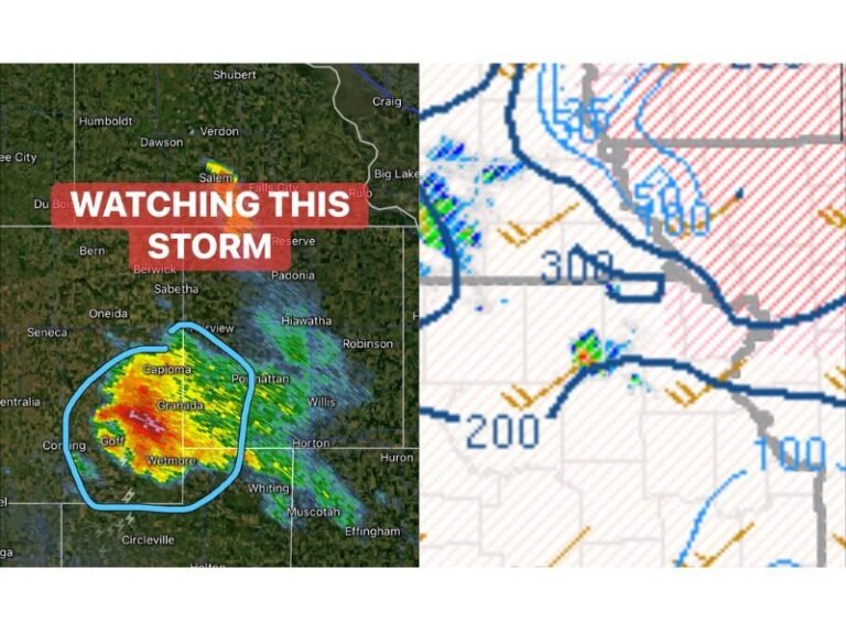
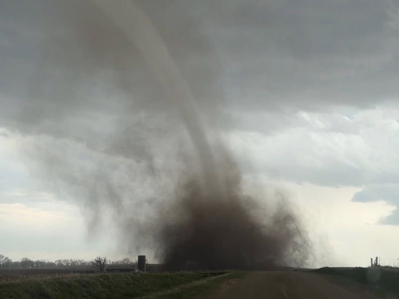
The fifth and final tornado of the chase occurred near Onslow, Iowa, and proved to be the most visually dramatic of the day. Chasers identified the storm on radar due to its distinctive sickle cell shape — a signature that experienced meteorologists recognize as a strong indicator of tornado development.
After repositioning from the HP storm complex, chasers arrived just as the tornado began forming along a rural road, allowing for a remarkably close view of the rope tornado touching down. The twister was located on private property and thankfully caused no reported damage, though its proximity to the chase crew made for an extraordinary and tense encounter in the field.
What HP Tornadoes Mean for Public Safety
High-precipitation supercells present a uniquely elevated danger to the public compared to classic supercell tornadoes. Because the tornado is wrapped in heavy rain and hail, residents in the storm’s path may have no visual warning before the twister reaches them. Standard visual cues that people are often advised to watch for — such as a visible funnel or debris cloud — may simply not be visible in HP storm environments.
Residents in tornado-prone areas of Iowa and surrounding states are strongly encouraged to rely on official weather alerts rather than visual confirmation when severe weather is nearby. A tornado warning should always be treated as a life-threatening event requiring immediate shelter, regardless of what can or cannot be seen outside.
Did you witness any of Tuesday’s tornado activity across Iowa? Share your account and stay connected with our severe weather reporting at SaludaStandard-Sentinel.com.