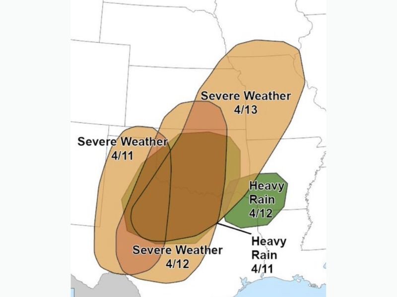
Texas, Oklahoma, Arkansas and Missouri Face Multi-Day Severe Weather Risk From April 11 to 13 With Heavy Rain Threat Expanding Into Mississippi Valley
UNITED STATES — A developing weather pattern is expected to bring multiple rounds of severe weather across Texas, Oklahoma, Arkansas, and Missouri from April 11 through April 13, with heavy rain also spreading into parts of the Mississippi Valley. The setup indicates a prolonged period of storm activity, with risks shifting across regions over several consecutive days.
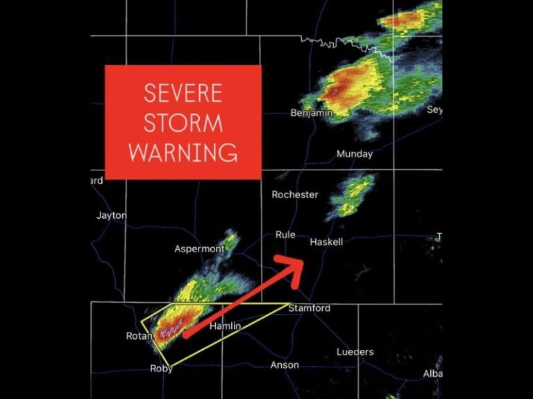
Severe Weather Risk Begins Across Texas and Oklahoma on April 11
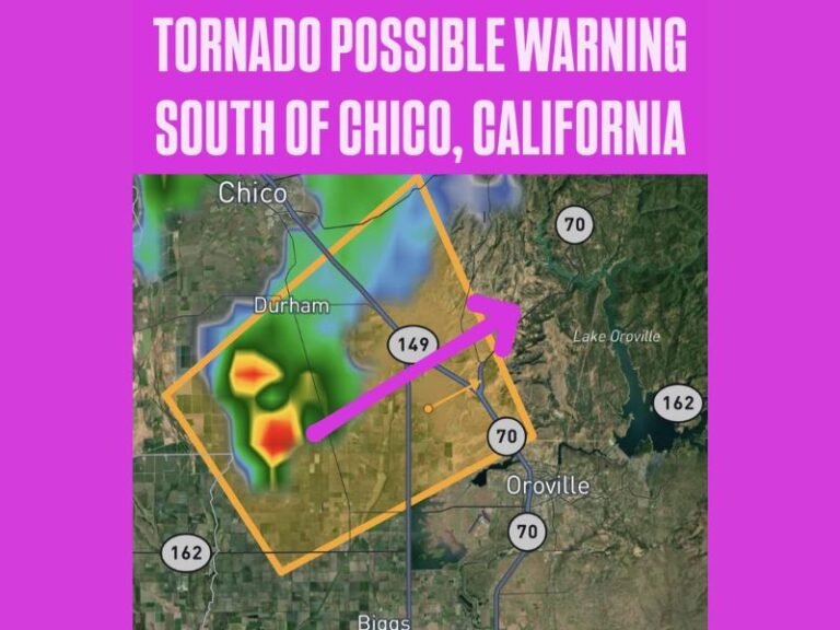
The first phase of this system is expected to develop across Texas and Oklahoma on April 11, where storms could begin forming and intensifying during the day.
This early stage may bring scattered severe storms capable of producing strong winds, hail, and localized heavy rainfall. At the same time, heavy rain is expected to develop farther southeast, particularly near parts of the lower Mississippi Valley and Gulf Coast regions.
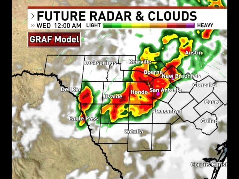
Storm Threat Expands Into Arkansas and Surrounding Areas on April 12
By April 12, the severe weather risk is forecast to expand northeast into Arkansas and surrounding areas, with a broader zone of storm activity developing.
This phase appears to carry a more widespread risk, with storms becoming more organized as atmospheric conditions strengthen. Heavy rainfall is also expected to intensify during this period, increasing the potential for localized flooding in affected areas.
Severe Weather Corridor Shifts Toward Missouri and Midwest on April 13
On April 13, the storm system is expected to push farther northeast into Missouri and nearby Midwest regions. This progression suggests a continuing severe weather threat, with storms potentially impacting a larger geographic area as the system moves forward.
While exact storm intensity and locations remain uncertain, the multi-day nature of this event raises concerns about repeated impacts across multiple states.
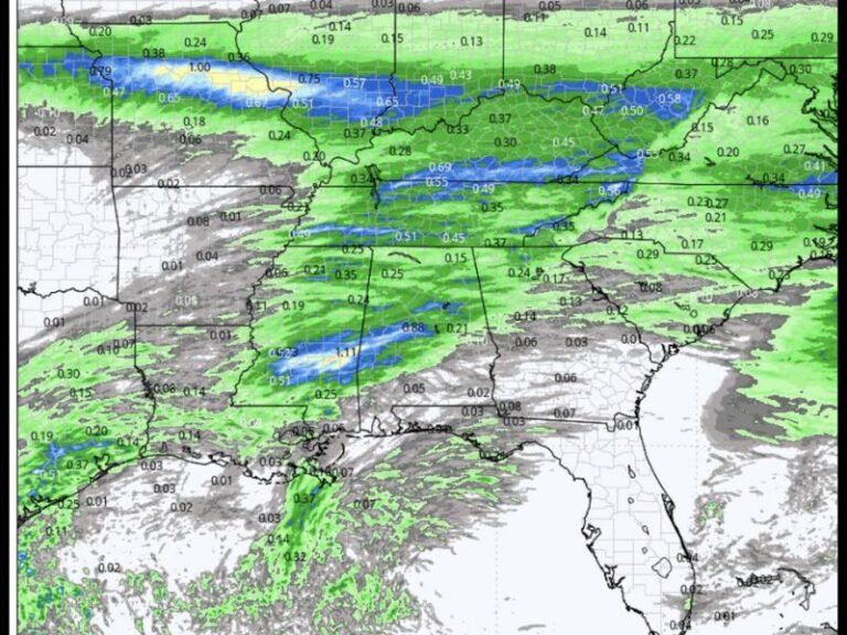
Heavy Rain Threat Builds Along Southern and Eastern Areas
Alongside severe storms, heavy rain is expected to impact areas south and east of the main severe weather corridor, particularly on April 11 and April 12.
These regions could see sustained rainfall, increasing the risk of localized flooding and water accumulation. The overlap of storm activity and heavy rain may create compounding impacts in certain areas.
Multi-Day Pattern Raises Concern for Repeated Impacts
One of the key concerns with this setup is its duration. Rather than a single-day event, this pattern is expected to produce multiple rounds of storms over several days.
This increases the likelihood of repeated impacts in some areas, including saturated ground conditions and heightened flood risk. Residents in affected states should be prepared for changing conditions each day as the system evolves.
Conditions Still Developing Ahead of Event
While the overall pattern is becoming clearer, specific details regarding storm strength and exact locations will continue to evolve in the coming days. Forecast updates will provide more precise information as the event approaches, particularly regarding severe storm potential.
Residents are encouraged to stay informed and monitor local weather updates as this multi-day system develops. Are you in the path of this upcoming severe weather stretch? Share your thoughts and preparations with us at SaludaStandard-Sentinel.com.