April Snow Showers Return to Pennsylvania and New Jersey as Temperatures Drop 15 to 25 Degrees Below Normal Early This Week
PENNSYLVANIA AND NEW JERSEY — A sudden return to winter-like conditions is expected early this week as a deep trough settles across the eastern United States, bringing snow showers and sharply colder temperatures.
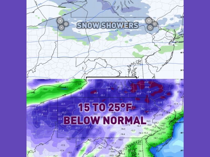
The pattern shift will allow much colder-than-average air to push into the region, setting the stage for snow showers Monday evening into the overnight hours, especially across northern areas.
Snow Showers Expected Monday Night Across Northern Areas
Forecast data indicates that snow showers will develop Monday evening and continue into the overnight period. The highest chances are expected along and north of the Interstate 80 corridor.
Areas in northern Pennsylvania and nearby regions stand the best chance of seeing accumulating snow showers, while lighter snow or even snow pellets could extend farther south at times.
Moisture combined with the incoming cold air will be just enough to support these brief but notable snow events, even as the calendar moves deeper into April.
Temperatures Set to Drop 15 to 25 Degrees Below Normal
One of the most impactful aspects of this system is the sharp temperature drop expected across the region. Afternoon highs on Tuesday could run 15 to 25 degrees below normal for this time of year.
In northern Pennsylvania and higher elevations, temperatures may struggle to rise beyond the low 30s, while southeastern areas could remain stuck in the low 40s. This dramatic cooling will make it feel much more like winter than spring, catching many off guard after recent milder conditions.
Cold Air Will Impact Entire Region Regardless of Snow
Even in areas that do not see significant snowfall, the cold air mass will be widespread and noticeable. Residents across Pennsylvania, New Jersey, and surrounding areas should prepare for a chilly start to the workweek, with cold mornings and brisk daytime conditions continuing into Tuesday.
The widespread nature of the cold means that nearly everyone in the region will feel the effects, regardless of whether snow develops locally.
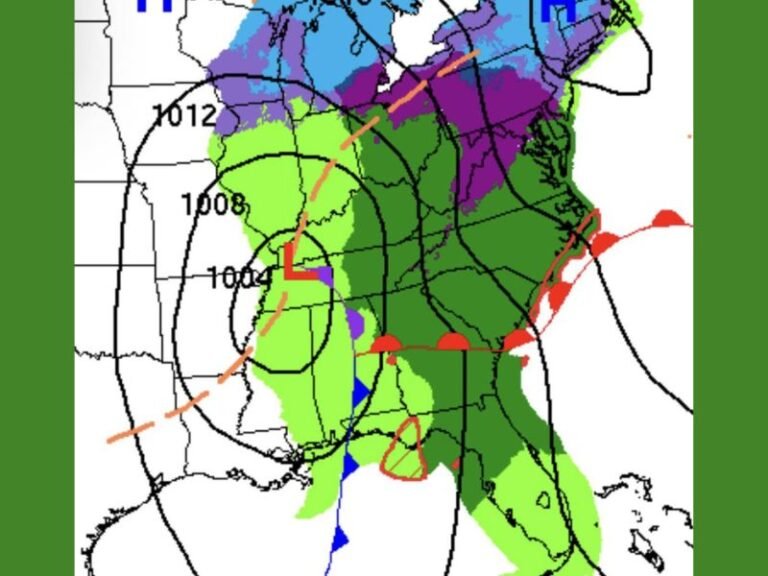
Why This Late-Season Cold Blast Is Happening
The return of winter-like conditions is being driven by a deep upper-level trough settling over the eastern United States. This type of pattern allows colder air from the north to move southward into the region.
When combined with available moisture, it can produce late-season snow showers, especially in areas that are already prone to cooler conditions. These setups are not uncommon in early spring but can still bring impactful weather when temperatures drop this sharply.
What Residents Should Expect Heading Into the Week
Residents should be prepared for a brief return to winter conditions, including the possibility of slick spots in areas where snow showers develop overnight. Dressing in layers, allowing extra travel time, and staying updated on local forecasts will be important as conditions change quickly.
While this cold snap is expected to be temporary, it serves as a reminder that winter weather can still make an appearance even in April. As this cold blast moves through, are you seeing snow or just feeling the chill in your area? Share your experience with us at SaludaStandard-Sentinel.com.