Historic Super El Niño Shift Could Bring Heavy Rain From California to Florida, Milder Northern Winters and Rising Flood Risks Nationwide
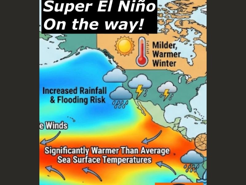
UNITED STATES — Climate models indicate a major shift is underway in the Pacific Ocean, with a potentially historic Super El Niño expected to develop later this year, bringing widespread weather changes across the country.
This transition out of a neutral phase is already signaling major impacts, including heavier rainfall across southern states, milder winters in the north, and an increased risk of flooding and extreme weather events.
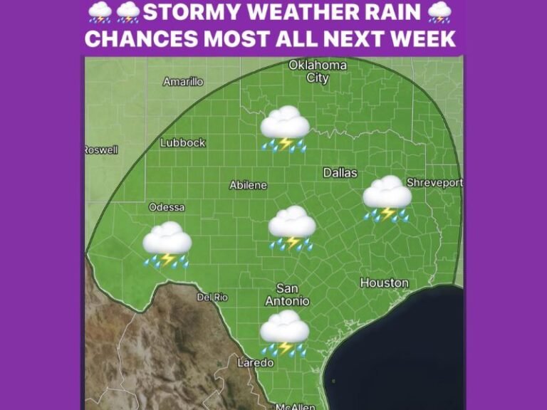
Southern United States Could See Heavy Rain and Flooding Risks
One of the most immediate impacts of a strengthening El Niño is a shift in the jet stream, which typically moves further south during these events. This change directs storm systems across the southern tier of the United States.
From California through the Gulf Coast and into Florida, residents could see significantly wetter conditions than usual. Increased rainfall over extended periods raises the likelihood of flooding, particularly in regions prone to water buildup.
As the system strengthens through summer and into fall, repeated storm activity may lead to saturated ground conditions, making even moderate rainfall events more impactful.
Northern States and Midwest Likely to Experience Milder Winters
In contrast to the wetter southern pattern, the northern United States and Midwest often experience milder winters during strong El Niño years.
Temperatures in these regions are expected to trend warmer than average, with snowfall totals likely falling below normal levels. This could reduce the frequency of major winter storms and limit snow accumulation across key northern areas.
While this may provide some relief from harsh winter conditions, it also reflects a broader shift in atmospheric patterns influenced by warming ocean temperatures.
West Coast Faces Complex Weather Threats Including Landslides
The West Coast is expected to face a more complicated set of impacts. While increased rainfall can help ease drought conditions in some areas, it often arrives in intense bursts during strong El Niño cycles.
This pattern raises concerns about landslides, especially in regions with steep terrain or areas previously affected by wildfires. Coastal erosion may also become a concern as repeated storm systems impact shoreline communities. The combination of heavy rain and unstable ground conditions could create localized hazards, particularly as the system gains strength.
Global Heat Trends Could Intensify Alongside El Niño
Another major concern tied to a Super El Niño is its role in increasing global temperatures. These events release stored heat from the ocean into the atmosphere, contributing to broader warming trends.
Early projections suggest that the upcoming year could rank among the hottest on record globally, driven in part by this developing climate pattern. This added heat can further amplify weather extremes, influencing everything from storm intensity to seasonal temperature swings.
What Residents Across the U.S. Should Prepare For
As the country moves toward this potential Super El Niño phase, residents should prepare for a noticeable departure from typical weather patterns.
Southern states should stay alert for prolonged rainfall and possible flooding, while northern regions may see a less severe winter season. On the West Coast, attention should focus on heavy rain events and related risks like landslides.
With conditions expected to evolve over the coming months, staying updated on local forecasts will be critical as this powerful climate pattern develops. As this major weather shift unfolds, how do you think it will impact your area? Share your thoughts and experiences with us at SaludaStandard-Sentinel.com.