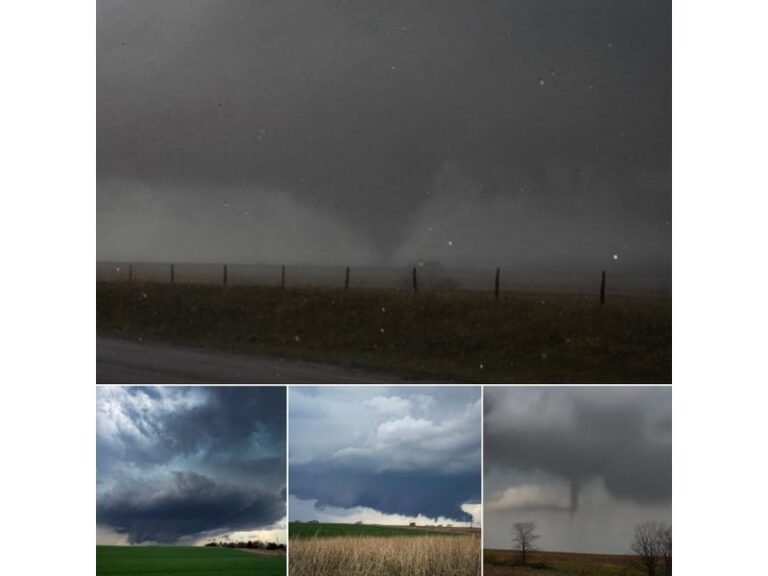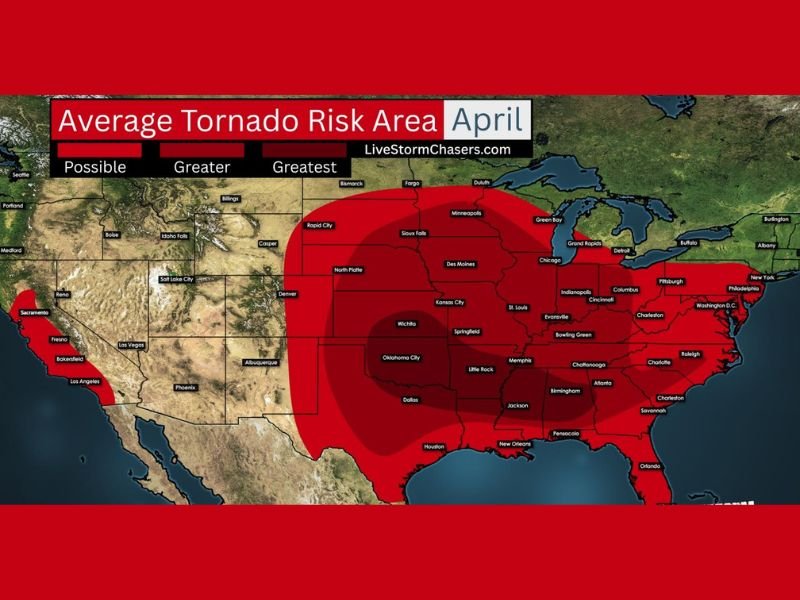
Texas, Oklahoma, Kansas, Nebraska, Missouri, Arkansas, Louisiana, Mississippi, Alabama, Tennessee, Kentucky, and More Enter Peak April Tornado Risk Zone
UNITED STATES — As April begins, meteorologists are warning that tornado season is rapidly intensifying across a large portion of the central and eastern United States, with conditions becoming increasingly favorable for severe weather outbreaks.
A broad region stretching from the Southern Plains through the Midwest and into parts of the Southeast is entering what is historically one of the most active periods for tornado development.
Central Plains and Midwest See Rising Tornado Potential
States including Texas, Oklahoma, Kansas, Nebraska, Missouri, and Arkansas are positioned within the core of the highest tornado risk zone for April.
This region, often referred to as “Tornado Alley,” typically sees a sharp increase in storm activity during this time of year as atmospheric conditions become more volatile.
The combination of warm air from the Gulf of Mexico and lingering cooler air from the north creates a setup that is highly favorable for strong thunderstorms and rotating supercells.
Dixie Alley and Southeast Also Face Elevated Risk
The threat is not limited to the Plains. Areas across Louisiana, Mississippi, Alabama, Tennessee, Kentucky, Georgia, South Carolina, and North Carolina are also included in an elevated risk zone often known as “Dixie Alley.”
Tornadoes in this region can be particularly dangerous due to factors such as higher population density, nighttime storm events, and terrain that can limit visibility. As April progresses, these areas may experience an increase in severe weather days, including the potential for damaging tornadoes.
Why April Is a Critical Month for Severe Weather
April marks a transitional period in the atmosphere, where warm, humid air begins surging northward from the Gulf of Mexico while the winter jet stream remains active across the United States.
When these two elements interact, they create instability in the atmosphere. This instability is a key ingredient for severe thunderstorms, which can produce tornadoes, large hail, and damaging winds. Meteorologists emphasize that this combination can lead to rapid storm development, sometimes with little warning.
Conditions Can Escalate Quickly During Spring Patterns
Spring weather patterns are known for their volatility, and April is often one of the most active months for severe weather across multiple regions at once. Storm systems moving across the country can trigger severe weather outbreaks over large areas, impacting several states simultaneously.
The presence of strong wind shear—changes in wind speed and direction with height—further increases the likelihood of rotating storms capable of producing tornadoes.
Preparedness Is Key as Season Ramps Up
With tornado risk increasing, officials are urging residents across affected states to review safety plans and ensure they have multiple ways to receive weather alerts. Checking emergency supplies, identifying safe shelter locations, and staying informed about forecast updates are all critical steps during this time of year.
Early awareness and preparation can make a significant difference when severe weather develops quickly. As April continues, the potential for strong storms will remain elevated, especially across the central and southeastern United States.
Have you experienced severe weather during past spring seasons, or are you preparing for this year’s storms? Share your thoughts and stay updated with the latest alerts at SaludaStandard-Sentinel.com.