North Carolina Cold Front Brings Winter Back: Chilly 40s–50s Return Statewide, Mountain Snow Possible Sunday Night
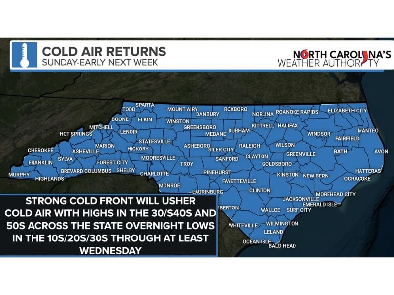
NORTH CAROLINA — A strong cold front is set to push winter back into the state starting Sunday, bringing a noticeable cool-down that could last into early next week — with highs slipping back into the 40s and 50s and overnight lows dipping into the 10s, 20s, and 30s across many communities.
Cold Air Expected to Linger Through Midweek
Forecasters say the cold pattern won’t be a quick, one-night chill. Instead, the incoming air mass is expected to keep temperatures below recent levels for several days. Daytime highs are projected to stay mainly in the 40s and 50s statewide, while nighttime readings fall sharply — especially in rural and sheltered areas where the wind calms down after sunset.
The cold stretch is expected to hold on through at least Wednesday, meaning residents may want to plan for multiple mornings of frost, cold-start commutes, and higher heating demand.
Overnight Lows Could Drop Into the 10s and 20s in Colder Spots
The biggest impact may come overnight, when temperatures are expected to fall into the 10s and 20s in the coldest areas, with many other towns landing in the 30s. That range increases the risk of slick spots early in the day where moisture lingers, particularly on bridges and shaded roadways.
It also means pets, pipes in exposed areas, and anyone without reliable heat may need extra attention as the cold locks in.
Mountain Snow Possible in High Elevations Sunday Night
While most of North Carolina will see the cold mainly as dry, winter-like air, the highest elevations in the mountains could see a more classic winter return. Snow is considered likely Sunday night in favored northwest-flow areas, and several inches may be possible where conditions line up.
Even if lower elevations stay rain-free, mountain travelers should be prepared for changing road conditions and reduced visibility in heavier bursts.
A Nice Night Before the Weather Flips
Before the front arrives, much of the state is expected to enjoy a pleasant stretch, giving residents a short window to get outside or handle errands before the colder air settles in.
What are you seeing in your area — are you already feeling the temperature drop, or planning for mountain travel Sunday night? Share what you’re noticing and help others stay prepared by joining the conversation at SaludaStandard-Sentinel.com.


