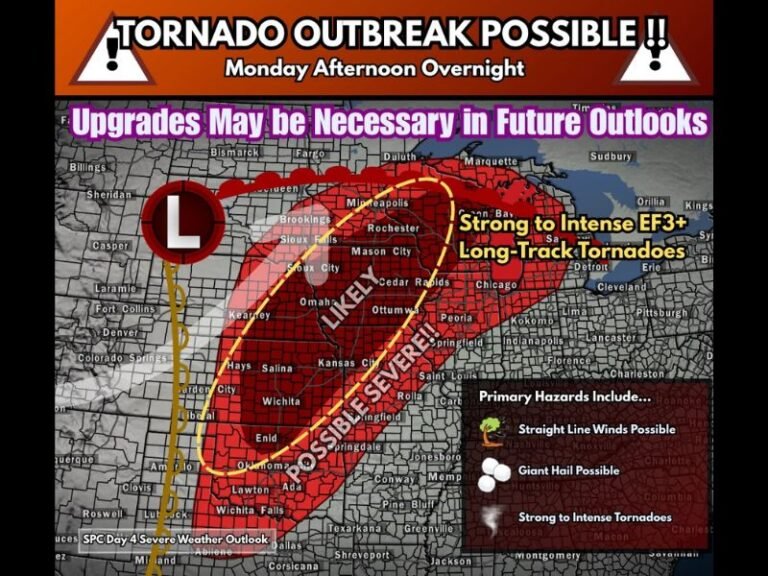
Southeast and Mid-South Trend Toward a Colder, Wintry Pattern Next Weekend as European Models Shift Away From Stormy Setup
UNITED STATES — Forecast guidance from European weather models is increasingly favoring a colder, more wintry setup for next weekend, as ensemble averages trend away from a storm-driven pattern and toward broader cold air coverage across the eastern half of the country.
The latest data highlights a noticeable temperature shift developing during the second half of February, reinforcing what has already been an active and volatile winter pattern.
European Ensemble Models Trend Colder
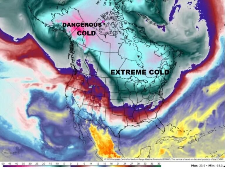
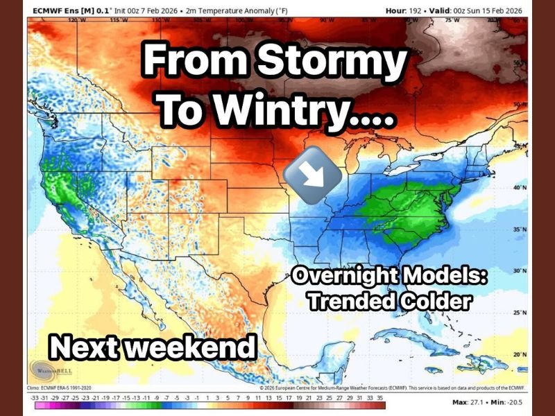
The average of multiple European ensemble runs shows a clear move away from a warmer, storm-focused look and toward colder conditions. Temperature anomaly data indicates below-average readings expanding across parts of the Southeast, Mid-South, and Ohio Valley as next weekend approaches.
This shift suggests colder air may play a larger role than previously expected, increasing the potential for wintry weather instead of rain-driven systems.
From Stormy Signals to a Wintry Look
Earlier model runs leaned more toward a stormy setup, but overnight guidance has consistently trended colder. The newest ensemble projections show cold air pressing farther south, altering how incoming systems may behave.
While this does not lock in any specific winter storm, it changes the background pattern in a way that favors snow or mixed precipitation should systems move through.
February Pattern Remains Active and Unpredictable
Forecasters emphasize that February continues to deliver frequent shifts, with neither quiet nor stable conditions dominating for long. The evolving pattern underscores how quickly forecast confidence can change during late winter.
Even if individual storm details remain uncertain, the broader signal points to continued weather volatility.
Next Model Runs Will Be Key
Meteorologists will closely watch upcoming model updates to see whether the colder trend holds or swings back toward a stormier setup. Either outcome would maintain an active weather regime heading into next weekend.
At this stage, the takeaway is awareness rather than alarm, as colder background conditions can amplify impacts if precipitation develops.
Are you noticing how changeable this winter has been where you live? Share your observations and stay up to date with continued coverage at SaludaStandard-Sentinel.com, where we track evolving weather patterns affecting communities across the United States.