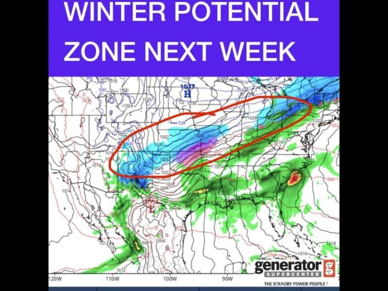
North Carolina and South Carolina Snow Forecast Holds at 3–6 Inches as New GFS Model Signals Banding Risk Saturday
NORTH CAROLINA AND SOUTH CAROLINA — The latest GFS weather model update shows snowfall projections holding steady across much of the Carolinas, reinforcing expectations of a widespread 3 to 6 inches of snow on Saturday, with locally higher amounts possible where intense snow bands develop.
Forecasters say confidence is growing that the overall setup remains on track, even as small placement changes could significantly affect totals from town to town.
New GFS Run Confirms Widespread Snow Potential
According to the newest GFS guidance, most inland areas of North Carolina and South Carolina remain firmly within the moderate snowfall zone, with totals clustering between 3 and 6 inches. Some higher-elevation and interior locations could exceed that range if snow bands persist.
While the European model continues to be favored for higher confidence, meteorologists note that the GFS run aligns closely with earlier forecasts, increasing confidence that a significant winter event is still expected.
Snow Banding Could Create ‘Jackpot’ Areas
One of the biggest uncertainties remains snow banding, a phenomenon similar to summertime thunderstorm bands. These narrow but intense corridors of snowfall can cause sharp differences in totals over short distances.
Some communities could see persistent heavy snow, while neighboring towns may receive noticeably less. This setup raises the possibility of localized “snow jackpot” zones, particularly across central and eastern portions of the Carolinas.
Cold Air May Boost Snow Totals Beyond Baseline
The current snowfall estimates are based on a 10:1 snow-to-liquid ratio, which may underestimate totals given how cold the air mass is expected to be. Colder temperatures often produce lighter, fluffier snow, allowing accumulations to exceed initial projections.
If colder trends continue, forecasters warn that snow totals could be adjusted upward in later updates.
What This Means for Travel and Preparation
With snow expected to fall steadily through Saturday, travel impacts are likely, especially in areas that experience banding. Roads could become snow-covered quickly, and visibility may drop during heavier bursts.
Residents are urged to monitor updates closely, as small forecast shifts could lead to meaningful changes in expected snowfall totals.
Saluda Standard-Sentinel will continue providing updates as newer model data becomes available and snowfall projections are refined. For continued local winter weather coverage and alerts, visit SaludaStandard-Sentinel.com.