Another Arctic Surge Targets North Texas to End January as Two Cold Blasts Drive Temperatures Into the Teens and Wind Chills Into Single Digits
NORTH TEXAS — Another round of Arctic air is set to close out January across North Texas, with forecasters warning of two separate cold blasts that will drive temperatures sharply lower, push wind chills into the single digits, and keep icy conditions lingering through the weekend.
Meteorologists say the pattern will bring a brief cool-down Friday followed by a stronger surge Saturday that keeps temperatures below freezing for much of the day.
First Cold Blast Arrives Friday Night
The first surge of Arctic air is expected to arrive Friday, with daytime highs topping out in the low 40s before temperatures fall rapidly overnight. By early Saturday morning, many areas are expected to wake up to temperatures in the teens as colder air pours into the region.
This sharp temperature drop could refreeze moisture on roadways, increasing the risk of slick conditions, especially overnight and early morning.
Second Arctic Surge Brings All-Day Freeze Saturday
A stronger Arctic surge is forecast to arrive Saturday, preventing temperatures from rising above freezing throughout the day. Wind chills Saturday morning are expected to dip into the single digits, making it feel significantly colder than actual air temperatures.
Despite sunshine during the afternoon, highs are only expected to reach near 30 degrees, offering little relief from the cold.
Cold Mornings Continue Into Sunday and Monday
Sunday morning is expected to begin with temperatures back in the teens before a modest rebound into the low 40s during the afternoon under sunny skies. The reprieve will be short-lived, however, as Monday morning temperatures are forecast to fall back into the 20s.
This repeated cycle of freezing and thawing increases the likelihood that shaded areas and untreated roads remain icy.
Icy Side Roads Remain a Concern
While main highways may improve as conditions stabilize, forecasters warn that secondary roads, neighborhood streets, and less-traveled routes could retain patches of ice through the weekend. Drivers are urged to use caution, especially during early morning and nighttime hours.
Officials also recommend taking precautions to protect pipes, including dripping faucets during the coldest periods.
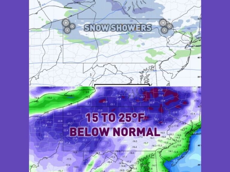
Arctic Pattern Keeping Temperatures Well Below Average
Temperature anomalies show North Texas running 20 to 35 degrees below average, underscoring the intensity of this late-January Arctic pattern. While brief warming spells may occur, winter is not loosening its grip just yet.
Residents are encouraged to stay weather-aware, plan travel carefully, and prepare for continued cold as January comes to a close. How is your community preparing for this latest Arctic surge? Share your local conditions and stay updated with ongoing coverage from SaludaStandard-Sentinel.com.