Texas Braces for Another Arctic Blast as Polar Vortex Pushes Reinforced Cold Air Into the State Friday and Saturday
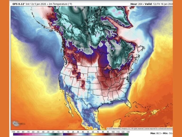
TEXAS — Forecast data indicates another reinforced Arctic air mass will surge into Texas late this week, bringing multiple nights below freezing, icy morning hazards, and temperatures well below seasonal averages. This system follows an already cold stretch and will be driven by a piece of the polar vortex dropping south, reinforcing cold air already in place across the region.
Cold Week Ahead With Freezing Nights Across Texas
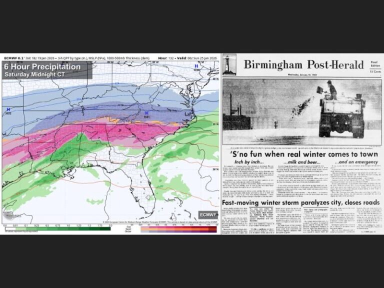
Every night this week is expected to fall below freezing across large portions of Texas, setting the stage for ongoing cold-related impacts. While some limited melting may occur Tuesday, temperatures will drop again quickly, allowing freezing fog to develop early Wednesday morning, particularly in areas where moisture lingers.
With temperatures in the 20s, even light fog could create slick and icy road conditions, making the Wednesday morning commute potentially hazardous in spots.
Reinforced Arctic Front Pushes South Through the State
Forecast models remain consistent in showing a reinforced Arctic front sliding southward into Texas, driven by energy spilling out of the polar vortex. This “back-door” cold front will reinforce cold air rather than bring moisture, meaning no widespread precipitation is expected, but temperatures will continue to fall.
By Friday, daytime highs are expected to struggle into the mid-30s, with temperatures dropping into the teens by Friday night in many locations.
Saturday Brings the Coldest Surge of the Week
A second surge of Arctic air arrives Saturday, pushing temperatures even lower. Northern Texas counties are likely to remain below freezing all day, while parts of the DFW Metroplex may hover just above freezing during peak afternoon hours.
This surge will reinforce the cold air mass, preventing any meaningful warm-up until late in the weekend.
Frigid Sunday Morning Before Modest Improvement
Conditions are expected to clear out Saturday night, allowing for strong radiational cooling. By Sunday morning, temperatures in the DFW Metroplex may fall into the 15–19 degree range, marking one of the coldest mornings of the season.
Temperatures should recover somewhat Sunday afternoon, with highs returning to the 40s, but this remains well below normal for late January.
Well Below Average Temperatures All Week Long
This prolonged cold spell will keep temperatures far below climatological averages throughout the week. The average high for this time of year is near 58 degrees, and forecasts suggest temperatures will not come close to that mark all week.
Residents should continue to prepare for:
- Extended freezing conditions
- Icy morning travel
- Increased strain on plumbing and heating systems
- Cold exposure risks for pets, livestock, and vulnerable populations
Stay alert as this Arctic pattern continues to evolve. Share how conditions look in your area and follow ongoing updates from SaludaStandard-Sentinel.com.