Narrow Snow Band Creates Sharp Cutoffs As New England Storm Produces Highly Uneven Totals
NEW ENGLAND — A winter storm moving through the region is producing dramatically uneven snowfall, with some communities seeing significant accumulation while others report almost nothing—an outcome forecasters say is directly tied to a very narrow, sharply defined snow band. Updated timing maps and radar scans confirm the system is performing within expectations, though its structure is causing noticeable confusion and frustration among residents.
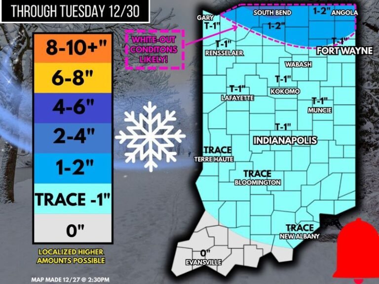
Uneven Snowfall Due To Norlun Trough Setup
Meteorologists explain the storm is being driven by a Norlun Trough, an elongated ribbon of contrasting temperature and pressure that can intensify snowfall in extremely tight corridors. Because of this setup, totals can vary from 10 inches in one town to only a dusting a mile away.
Forecasters emphasize that a projected 0–2 inch range still means anywhere from nothing up to two inches, depending on whether a community falls under the narrow band. The system’s earlier potential was also reduced when warm southern air interacted with very cold air aloft, weakening the broader snowfall field.
Storm Timing Largely Matches Early Forecasts
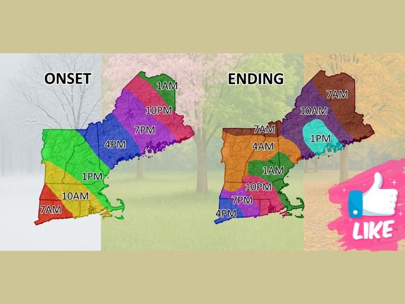
Despite online complaints from residents who saw less snow than expected, the overall start and stop times have aligned closely with prior forecasts. Southern New England was expected to see an onset window between 7–10 a.m., with precipitation tapering off between 4–7 p.m. on Wednesday.
Norlun-driven systems commonly feature irregular pauses, sudden bursts, and unpredictable fluctuations, making minute-to-minute forecasting difficult. The broader timing, however, remains accurate.
What Residents Should Expect Overnight
The storm’s narrow snow band will continue to shift and wobble through the overnight hours, and radar trends will determine whether any areas pick up localized bursts of heavier snow. Because of the sharp cutoff line, travel conditions may differ significantly over short distances.
Residents are urged to remain alert to rapid changes, as tiny shifts in the snow band can drastically change totals and visibility. For more weather updates and local coverage, visit SaludaStandard-Sentinel.com.