U.S. Braces for Unsettled Pre-Christmas Weather as Multiple Cold Fronts Challenge Forecast Models
UNITED STATES — Meteorologists are warning of an unpredictable weather pattern leading into Christmas week, as new model runs show multiple cold fronts sweeping across the nation between December 17–20. Despite recent talk of a warm “blowtorch” setup, the latest GFS and European models indicate major temperature swings and the potential for sharp Arctic intrusions.
Forecast Models Split Ahead of the Holiday Week
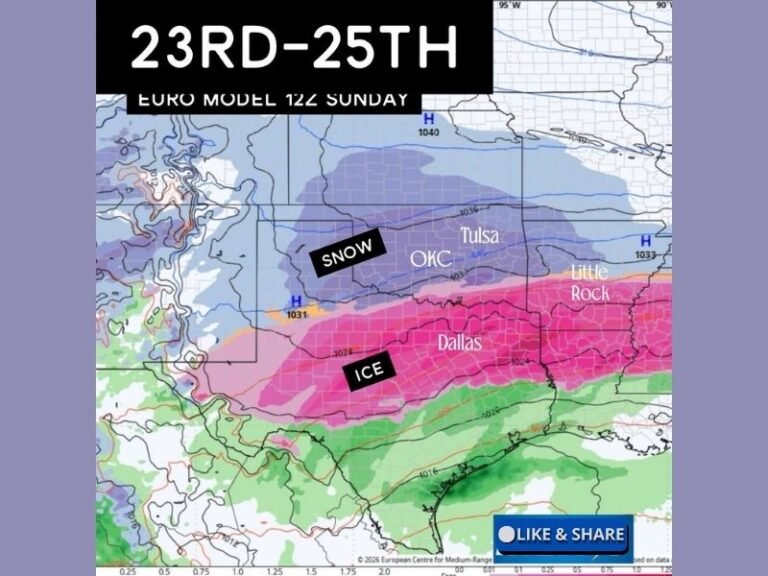
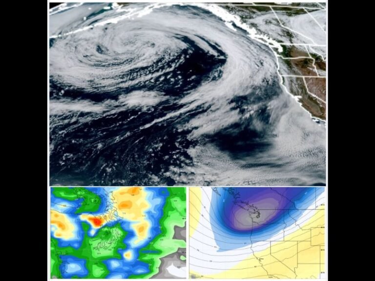
Recent projections from the GFS and ECMWF models show dramatic temperature contrasts across the U.S., with Arctic air gripping the Midwest and Great Lakes while milder conditions persist across parts of the South and East.
Meteorologist Chris Jones cautions against overconfidence in early predictions, calling some of the warm-weather chatter “half-baked Christmas forecasts.” He noted that the atmosphere “is acting feral — throwing multiple cold fronts at us like it’s cleaning out the freezer before New Year’s.”
High-resolution temperature maps show potential for freezing conditions across the Plains, Midwest, and interior Northeast, while parts of the Southeast and Gulf Coast could briefly see above-average warmth before the next cold surge arrives.
Temperature Swings Creating ‘Weather Whiplash’ Across Regions
The evolving pattern is expected to bring sudden shifts from mild to freezing in several regions, making it difficult for long-range forecasts to maintain accuracy. Meteorologists say that residents in the central and eastern U.S. should prepare for rapid temperature drops, gusty winds, and potential frost or snow showers as fronts move through.
“This weather’s got split personalities,” Jones said, describing it humorously as “sweatshirt at breakfast, AC arguing by lunch, socks and slides by dinner.”
In short — no region is fully locked in for a warm or cold Christmas just yet.
Meteorologists Urge Caution with Long-Range Holiday Forecasts
Jones warns that relying too heavily on single-run model maps can lead to confusion and false expectations. “Heat isn’t crowned. Cold air still has the key, the code, and bad intentions,” he said.
While early model runs briefly hinted at an unseasonably warm “torch” setup for the holiday, subsequent data shows repeated Arctic fronts reloading from the north, challenging the notion of an extended warm spell.
The consensus among forecasters is that multiple systems will likely slide through between December 17 and 22, keeping much of the country on alert for temperature drops, gusty winds, and changing precipitation patterns.
What Residents Should Expect
- Central U.S.: Periodic Arctic air intrusions, gusty winds, and freezing temperatures.
- East Coast: A mix of mild and cold days as fronts move through.
- South and Gulf States: Brief warm-ups followed by sharp cool-downs.
- West: Cooler than normal with potential mountain snow.
Residents are advised to keep coats and cold-weather gear close — and to prepare for quick shifts between chilly mornings and warmer afternoons.
“Keep the coat close, keep receipts, and stop trusting one spicy map like it’s the Bible,” Jones quipped, reminding followers that winter forecasting remains fluid heading into Christmas week.
For ongoing updates and expert analysis of upcoming holiday weather patterns, visit SaludaStandard-Sentinel.com.