Wyoming, Colorado and Nebraska Face Powerful Arctic Front With 60 MPH Winds, Snow Squalls and Rapid 25° Temperature Drop
WYOMING, COLORADO AND NEBRASKA — A powerful Arctic cold front is sweeping south across the central Rockies and High Plains, bringing dramatic temperature drops, strong winds, and a rapid transition from rain to snow in several states overnight.
Meteorologists say the front has already blasted through Casper, Wyoming, where temperatures reportedly dropped about 25 degrees in a short period of time as rain quickly changed over to snow. The fast-moving system is continuing to push south and east, creating dangerous travel conditions across parts of Wyoming, Colorado, and Nebraska.
Cold Front Racing Toward Nebraska and Colorado
Weather observers report the cold front is currently moving quickly through the region and is expected to reach areas affected by the Morrill and Cottonwood fires in Nebraska within a few hours.
Behind the front, powerful north winds have already begun intensifying across parts of Wyoming and northern Colorado. Surface observations indicate wind gusts ranging from 40 to 60 miles per hour, which could create blowing snow and significantly reduced visibility in open areas. Forecasters say the system is still progressing rapidly and could reach the Denver area within several hours as colder air continues spilling south.
Rain Rapidly Changing to Snow Across the Region
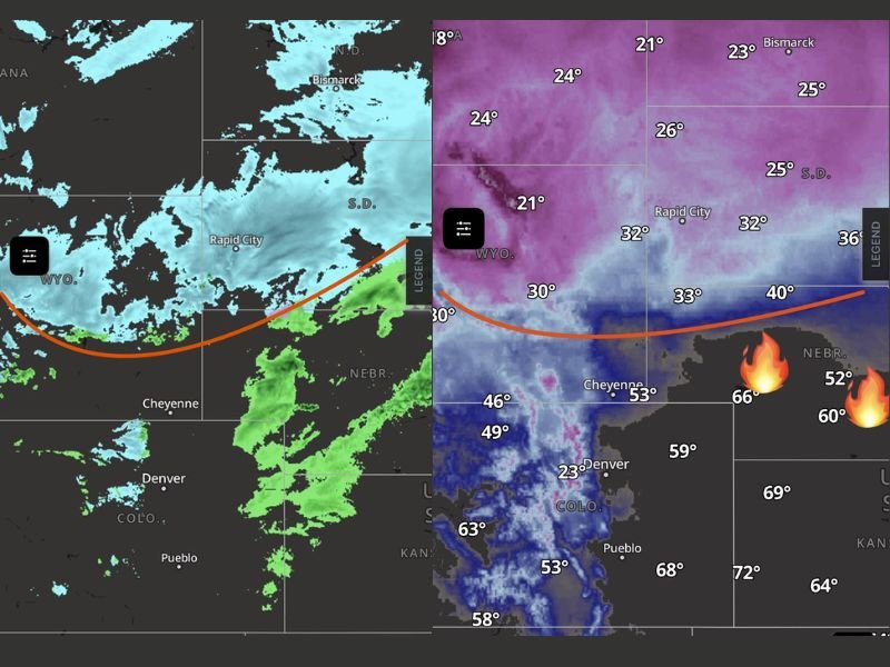
As the front pushes through, precipitation is quickly transitioning from rain to snow. Radar imagery shows bands of snow spreading across portions of Wyoming and the western Dakotas while rain showers linger farther south ahead of the front.
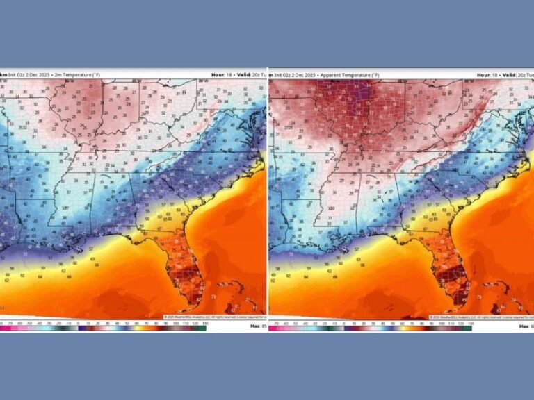
The sharp temperature contrast across the region is dramatic. Temperatures behind the front are falling into the 20s and low 30s, while locations ahead of it in eastern Colorado and western Nebraska remain in the 50s and even 60s. This sharp boundary is helping to fuel the rapid changeover from rain to snow and increasing the likelihood of brief snow squalls that can reduce visibility quickly.
Dangerous Travel Conditions Possible Overnight
Meteorologists warn that travel conditions may deteriorate quickly as the cold front continues moving across the region overnight.
Strong north winds blowing across highways could produce dangerous crosswinds, especially for high-profile vehicles. Drivers traveling along major routes such as Interstate 80, Interstate 76, and Interstate 70 may encounter difficult conditions including blowing snow, reduced visibility, and icy road surfaces.
Weather experts say some highways could become hazardous quickly if snow squalls develop behind the front. There is also concern that portions of U.S. Highway 287 between Fort Collins and Laramie could experience significant impacts if winds and snow intensify.
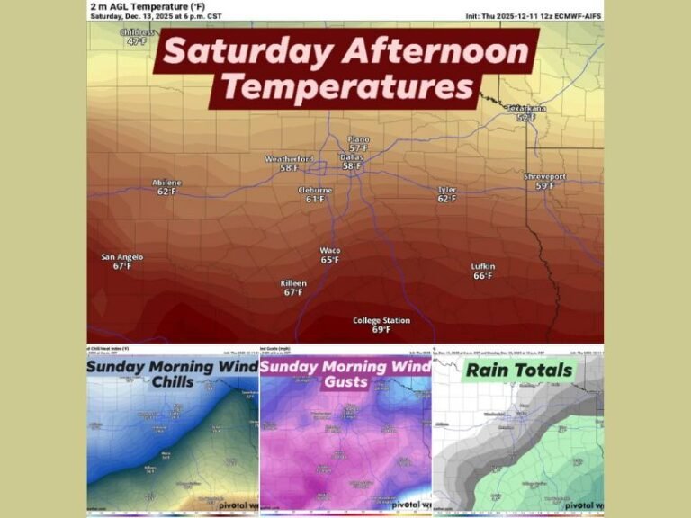
Bitter Wind Chills Expected by Sunday Morning
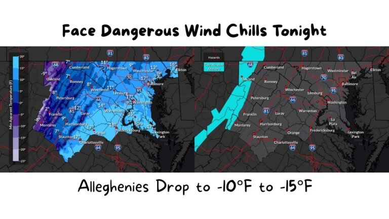
As the Arctic air mass settles into the region, temperatures are expected to fall sharply by early Sunday morning. Wind chills across parts of western Kansas and nearby High Plains areas could drop into the single digits and teens, while higher elevations in the Rocky Mountains may experience temperatures below zero.
These rapidly changing conditions highlight the intensity of the cold air surge moving across the central United States. Forecasters say the combination of strong winds, falling temperatures, and bursts of snow could continue producing difficult travel conditions through the overnight hours and into Sunday morning.
Residents across the region are urged to monitor local forecasts and avoid unnecessary travel if conditions worsen overnight. If weather conditions are changing in your area, share updates with the newsroom at SaludaStandard-Sentinel.com so readers across the country can stay informed about developing weather situations.