Western Carolinas Forecast: Rain Midweek, Cooler Temps by Late Week
GREENVILLE, S.C. — Residents across the western Carolinas and northeast Georgia should prepare for a shift in weather this week, with increased storm chances midweek followed by cooler air settling in by Friday.
Rain Chances Build Midweek
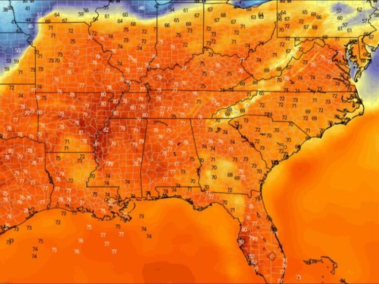
The National Weather Service in Greenville-Spartanburg reports that isolated afternoon showers and storms will continue through Tuesday. By Wednesday and Thursday, a frontal system will move into the region, bringing a higher likelihood of widespread rainfall and thunderstorms.
Motorists are advised to watch for slick roads during commutes, particularly Wednesday evening into Thursday night.
Cooler Air Moves In
After Thursday’s storm chances, temperatures will begin to trend downward. By the end of the week, highs are expected to drop to near or slightly below seasonal averages for late September, offering the region a taste of fall.
Forecasters say the change will be noticeable for residents who have grown accustomed to above-normal warmth so far this month.
Weekend Outlook
Skies are expected to clear heading into Saturday and Sunday, with cooler, drier conditions creating more comfortable weather for outdoor activities.
Do you welcome the cooler fall-like weather after a stretch of heat, or do you prefer the lingering summer warmth? Share your take with us at SaludaStandard-Sentinel.com.