Washington State Seattle and Puget Sound Brace for Midweek Rain and Mountain Snow Before Warmest Spring Weekend Surge Into 60s and Near 70 Degrees
WASHINGTON — A dynamic weather pattern is unfolding across Washington State this week, bringing a mix of midweek rain and mountain snow before a dramatic warm-up sets the stage for one of the nicest spring weekends so far in Seattle and across the Puget Sound region.
Forecasters say the shift will be noticeable, transitioning from a typical wet system into increasingly sunny and warmer conditions heading into the weekend.
Midweek Storm Brings Rain, Snow and Gusty Winds
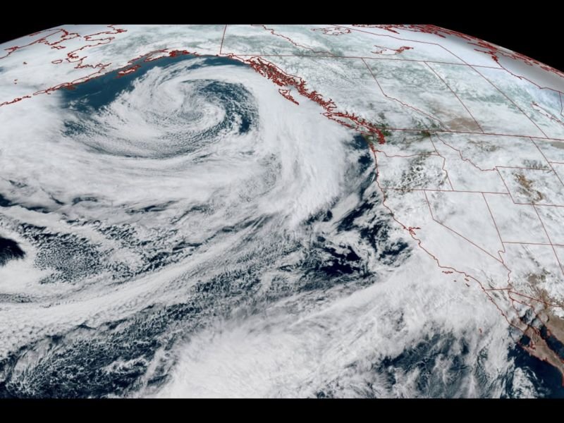
A moderate storm system is expected to move into Washington on Wednesday, delivering steady rain across the lowlands and accumulating snow in the mountains. Snowfall totals in higher elevations could reach around 4 to 8 inches, enough to create winter-like conditions in passes.
Along with precipitation, breezy winds will develop, especially in exposed coastal areas and the Northwest Interior, where gusts could exceed 40 mph. While not considered a high-impact wind event, it will add to the unsettled feel of the day.
Rainy Start Transitions to Showers by Evening
Rain is expected to begin during the morning hours Wednesday and continue through much of the day. By the evening commute, the main system should begin to move through, allowing steady rain to taper into more scattered showers.
Conditions will remain damp and breezy into the night before gradually improving toward early Thursday morning.
Thursday Marks the Turning Point Toward Better Weather
By Thursday, lingering clouds and a few isolated showers may stick around early, but increasing breaks of sunshine are expected by the afternoon. This marks the beginning of a pattern shift as high pressure begins to build into the region. Temperatures will also begin trending upward, setting the stage for a much warmer and more stable stretch of weather.
Sunny and Mild Conditions Take Over the Weekend
Friday will bring partly to mostly sunny skies with temperatures climbing into the upper 50s, offering a clear improvement from the midweek system.
The real change arrives over the weekend, with both Saturday and Easter Sunday expected to feature sunny conditions and highs around 60 degrees across much of the region. This would make it one of the more pleasant stretches of weather seen so far this spring.
Early Next Week Could Push Temperatures Near 70 Degrees
Looking ahead, the warming trend may continue into early next week, with some areas around Seattle potentially reaching the mid to upper 60s and even approaching 70 degrees.
However, forecasters caution that this early taste of warmer weather may not last long, as another round of showers and cooler temperatures could return by the middle of next week.
A Classic Pacific Northwest Weather Swing
This setup highlights the classic Pacific Northwest transition from wet and unsettled conditions to brief periods of sunshine and warmth during the spring season.
While the midweek storm will bring typical rain and mountain snow, the payoff arrives quickly with a stretch of comfortable and sunny weather just in time for the weekend.
Readers in Washington State are encouraged to share how conditions are changing in their area by visiting SaludaStandard-Sentinel.com.