Washington State Faces New Threat as Second Atmospheric River Brings Heavy Rain, Flooding, and Landslide Risks
SEATTLE, WA — Just days after catastrophic flooding swept across parts of northwest Washington, a second atmospheric river is bearing down on the region — threatening to unleash another round of torrential rain, flash floods, and landslides across already devastated communities.
Meteorologists warn that with rivers still swollen and soils fully saturated, this incoming storm could worsen flooding, trigger new mudslides, and force more evacuations in multiple counties, including Skagit, Whatcom, Snohomish, King, and Pierce.
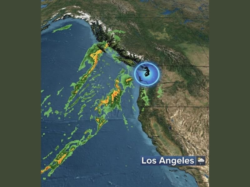
The National Weather Service (NWS) has issued multiple flood watches and warnings across western Washington, citing the extreme potential for renewed flooding as the next atmospheric river — a long, moisture-rich plume of Pacific air — moves inland late Monday night into Tuesday.
Communities Still Recovering Now Face New Round of Storms
Dozens of communities across northwestern Washington, including Sumas, Everson, Nooksack, Lynden, and Mount Vernon, are already struggling to recover from record-breaking rainfall and river flooding earlier this month.
Floodwaters damaged homes, washed out roads, and forced mass evacuations across Whatcom County, leaving hundreds displaced. Now, emergency officials say this second system could set recovery efforts back significantly.
“We’re urging everyone in flood-prone areas to prepare immediately,” said an NWS spokesperson in Seattle. “Rivers remain high, and with the ground completely saturated, even moderate rainfall could cause major impacts.”
Rainfall Totals Could Exceed Several Inches
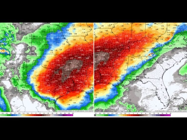
Forecast models show that Western Washington could receive 3 to 6 inches of additional rainfall through midweek, with locally higher amounts in the Cascade foothills and Olympic Peninsula.
This level of precipitation could quickly overwhelm small rivers and streams, particularly in the Skagit, Snoqualmie, and Nooksack River basins. The risk of mudslides and debris flows also remains elevated in steep terrain and burned areas.
Communities such as Fall City, Carnation, Skykomish, and Sedro-Woolley are expected to experience rapidly changing conditions as the atmospheric river strengthens.
Emergency Guidance and Safety Measures
Local and state agencies are working to deploy resources ahead of the storm, urging residents to follow official alerts and be ready to evacuate quickly if ordered.
Authorities stress the importance of:
- Moving to higher ground immediately if flooding begins.
- Avoiding travel through flooded roadways — even shallow water can sweep away vehicles.
- Staying informed via NWS updates and local emergency channels as conditions evolve.
A Pattern of Repeated Atmospheric Rivers
This marks the second major atmospheric river event to strike Washington in less than two weeks — part of a broader Pacific pattern delivering unrelenting moisture to the U.S. West Coast.
Meteorologists note that these systems can carry as much water vapor as the Mississippi River, often leading to record-breaking rainfall and extensive flooding when they repeatedly strike the same region.
“The back-to-back nature of these storms is the real concern,” said weather analyst Chris Jones. “The land has no time to drain or stabilize — each new wave compounds the damage from the last.”
Ongoing Flood Alerts and Next Steps
As of Monday evening, flood alerts remain in effect for much of western and northwestern Washington, with forecasters cautioning that conditions could worsen rapidly overnight.
Evacuation centers are being prepared in affected counties, and crews are monitoring levees and low-lying neighborhoods closely.
Residents are encouraged to check on neighbors, especially the elderly, and to keep emergency supplies, flashlights, and evacuation kits ready.
Stay updated on official warnings and local reports as this storm unfolds at SaludaStandard-Sentinel.com.