Washington Faces Major Snowfall Threat as Mountains Could See Up to 100 Inches by Saturday
SEATTLE, WASHINGTON — A powerful winter storm system is set to unload extraordinary amounts of precipitation across Washington next week, bringing with it both flooding concerns in low-lying areas and massive snowfall in the mountains. Forecasters warn that the state could face one of its heaviest snow events of the season, with 60 to 100 inches of snow expected in some of the highest elevations by Saturday morning.
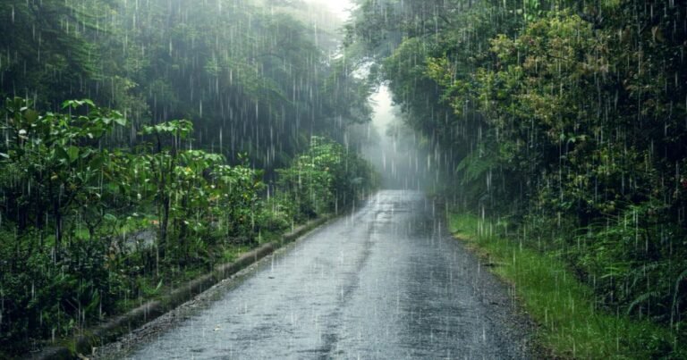
Heavy Precipitation Blankets the Pacific Northwest
Forecast models show a persistent flow of Pacific moisture streaming into western Washington, where 7-day precipitation totals could exceed 10 inches in many locations. While coastal and valley areas are likely to see several inches of rainfall, the Cascades and Olympic Mountains are expected to receive the brunt of the system’s impact as snow.
According to forecasters, much of this precipitation will fall as snow above 3,000 feet, significantly increasing snowpack across the mountain ranges. Some of the highest elevations could see 5 to 8 feet of snow accumulation, which may temporarily ease river flooding concerns by locking moisture into the snowpack rather than immediate runoff.
Flooding Concerns Despite Snow Offset
Although the snow will help limit short-term river flooding, meteorologists caution that the massive precipitation totals could still lead to localized flooding, especially in lower elevations and urban areas. Rivers that drain from the mountains — including the Skagit, Snoqualmie, and Nisqually Rivers — may rise quickly as the storm continues through the week.
“The concern is twofold,” said a meteorologist with the National Weather Service in Seattle. “While snow helps hold back runoff now, once temperatures rise, we could see significant melting and downstream flooding later.”
Residents in flood-prone communities are being advised to monitor forecasts closely, avoid driving through water-covered roads, and prepare emergency kits in case conditions worsen.
Mountain Travel to Become Extremely Hazardous
Travel through the Cascade mountain passes is expected to become treacherous, with near-zero visibility, deep snow accumulation, and possible road closures. The Washington State Department of Transportation has already warned drivers to avoid unnecessary mountain travel during the storm period.
Winter storm warnings are anticipated as conditions intensify. Authorities remind drivers to carry chains, warm gear, and emergency supplies when traveling through snowy regions.
Impact Extends Across the Region
The moisture plume fueling this event stretches from the Pacific Ocean into Oregon, Idaho, and parts of northern California, but Washington is projected to receive the highest precipitation totals. Coastal zones may see 3 to 5 inches of rainfall, while interior valleys such as Yakima and Wenatchee are expected to receive lighter precipitation but much colder temperatures.
By Saturday morning, much of the state’s mountain terrain will be buried under several feet of new snow, adding to an already substantial seasonal base. Ski resorts could benefit from ideal powder conditions once travel becomes possible again.
Residents Urged to Stay Alert and Prepared
Officials urge Washington residents to remain cautious and prepared for potential power outages, travel disruptions, and rapidly changing weather conditions. Emergency management agencies recommend checking weather alerts daily and ensuring homes are stocked with essentials, including food, batteries, and heating supplies.
As this powerful weeklong storm moves across the Pacific Northwest, it will test both infrastructure and preparedness — bringing beauty to the mountains but possible danger to communities below.
For ongoing weather coverage and regional alerts, visit SaludaStandard-Sentinel.com.