Valentine’s Day Winter Storm Threat Emerges Across Georgia and the Carolinas as Snow, Sleet, and Freezing Rain Signals Strengthen
SOUTH CAROLINA — A developing winter weather setup is raising concerns across parts of the Southeast, as forecast data indicates the potential for snow, sleet, and freezing rain impacting Georgia and the Carolinas during the Valentine’s Day period.
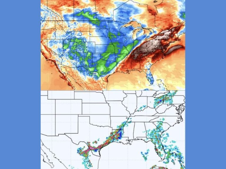
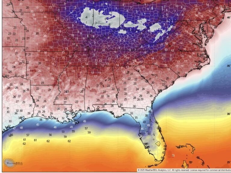
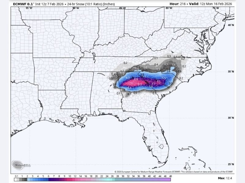
The latest European forecast model highlights a concentrated band of wintry precipitation setting up across the region between February 14 and February 16, with multiple precipitation types possible depending on storm track and temperature profiles.
European Model Highlights Wintry Precipitation Corridor
ECMWF snowfall projections show a narrow but intense zone of wintry weather stretching from central Georgia into South Carolina and portions of North Carolina. Within this corridor, model output suggests the potential for accumulating snow where colder air is firmly in place.
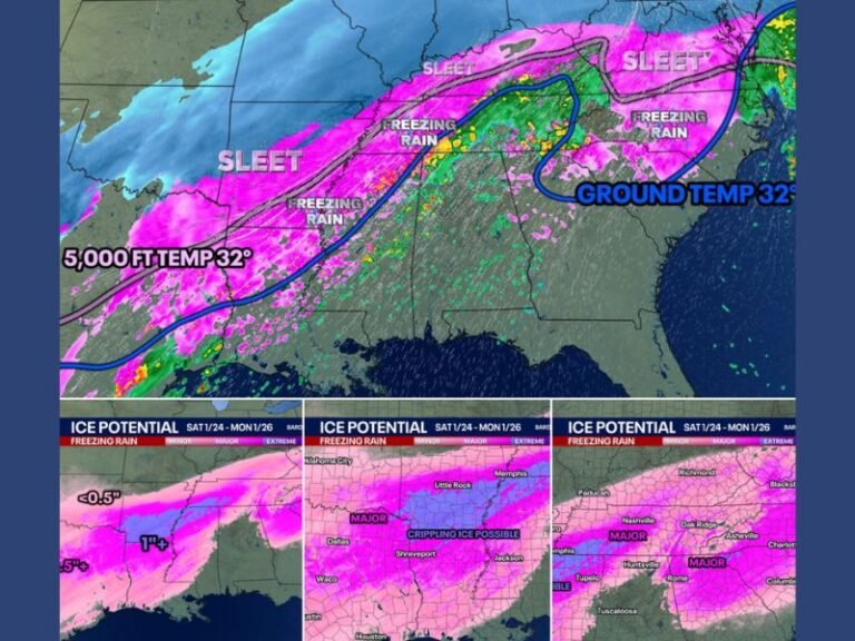
Surrounding this zone, areas on the warmer side of the system may experience sleet or freezing rain, increasing the risk for hazardous travel and ice accumulation.
Freezing Rain and Sleet Could Create Travel Hazards
The forecast indicates a stripe of freezing rain setting up near the transition zone between rain and snow. Even light ice accumulation can create dangerous road conditions, particularly on bridges, overpasses, and untreated surfaces.
Sleet accumulation is also possible in parts of the region, which can quickly coat roadways and sidewalks, making travel difficult even without heavy snowfall.
Timing Centers on Valentine’s Day Weekend
Current projections place the most active period between Friday night and Sunday, overlapping with Valentine’s Day weekend. Forecasters caution that small shifts in storm track could significantly alter which communities see snow versus ice.
Because of this uncertainty, residents are urged to monitor updates closely as the event approaches.
Forecast Still Developing, Changes Possible
Meteorologists stress that this system is not yet locked in, and precipitation type and amounts may change as newer data becomes available. However, the consistency in recent model runs suggests the setup is worth watching carefully.
Even modest winter weather impacts can have outsized effects in the Southeast, where ice and snow are less common.
If you have Valentine’s Day travel plans or events scheduled, now is the time to stay informed and prepare for possible disruptions. Share how you’re planning ahead and follow continued updates at SaludaStandard-Sentinel.com, where we track developing weather threats across South Carolina and the Southeast.