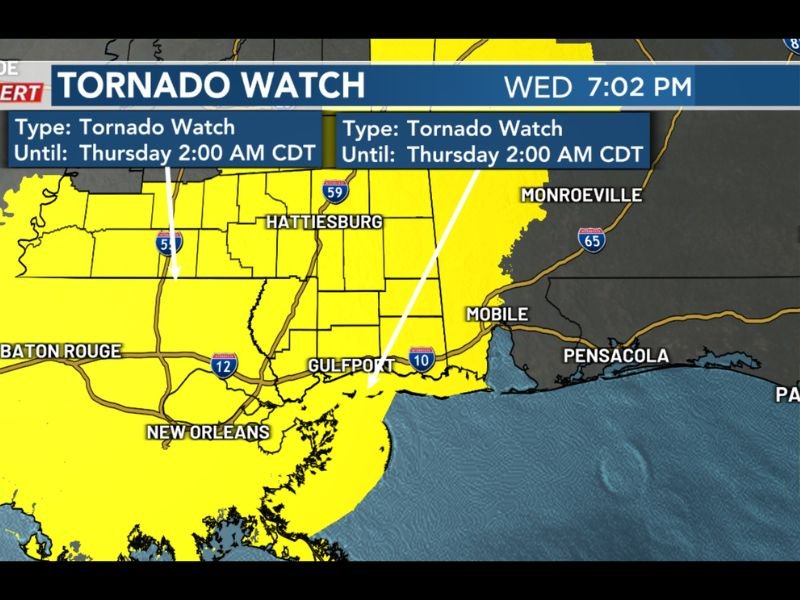
Tornado Watch Issued for South Mississippi Until 2 A.M. as Overnight Storm Line Could Bring Damaging Winds and Possible Tornadoes
MISSISSIPPI — A tornado watch has been issued for all of South Mississippi Wednesday evening as meteorologists warn that a line of storms could move into the region overnight with the potential for damaging winds and isolated tornadoes.
Weather officials say the watch will remain in effect until 2 a.m. Thursday morning as the developing storm system tracks across the Gulf Coast region. The storms are expected to approach the southern counties of Mississippi later in the evening and continue moving through the area during the overnight hours.
Forecasters say the greatest concern will be strong thunderstorms capable of producing damaging wind gusts, although a few tornadoes could also develop as the storms move across the region.
Storm Line Expected to Enter South Mississippi Late Tonight
Meteorologists say a line of storms is forecast to move into southern Mississippi after approximately 11 p.m., bringing heavy rain, gusty winds, and the possibility of severe weather. The storm system is expected to travel eastward across the region, impacting communities along the Mississippi Gulf Coast and inland areas including cities such as Gulfport and Hattiesburg.
As the storms move through, forecasters say conditions may become favorable for isolated tornado development within the stronger thunderstorm cells. While not every community will experience severe weather, residents across the watch area are being urged to remain alert overnight.
Damaging Winds the Primary Threat
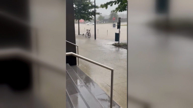
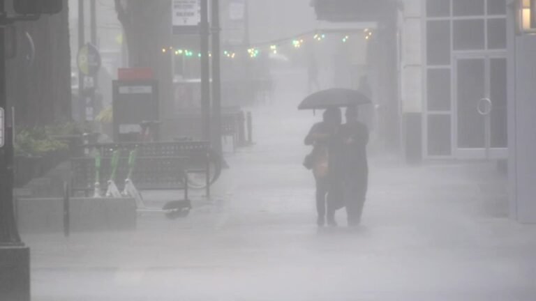
Weather officials say damaging wind gusts appear to be the main concern with this storm system. Strong thunderstorms embedded within the line could produce wind gusts capable of downing tree limbs, causing localized power outages, and creating hazardous travel conditions.
Heavy rainfall may also accompany the storms, potentially reducing visibility for drivers and leading to water accumulation on roads. However, meteorologists caution that a few storms could rotate enough to produce brief tornadoes, which is why the tornado watch remains in place.
Tornado Watch Covers Entire Southern Portion of the State
The tornado watch includes counties across the southern half of Mississippi and extends along the Gulf Coast region. This broad watch area allows meteorologists to monitor conditions closely as storms develop and move through the region overnight.
Cities across the watch zone are advised to keep weather alerts active on phones and weather radios so that warnings can be received quickly if tornadoes develop. Because the storms are expected to arrive late at night, officials stress the importance of remaining weather aware while sleeping.
Residents Urged to Stay Alert Overnight
Severe weather that develops overnight can be especially dangerous because many people may not be awake to hear warnings. Meteorologists encourage residents to have multiple ways to receive weather alerts, including weather radios and mobile alerts, in case tornado warnings are issued. Residents are also advised to identify a safe place in their homes where they can quickly seek shelter if storms intensify.
Forecasters will continue monitoring radar and storm development throughout the night as the line of storms approaches the Gulf Coast. Readers across Mississippi who experience severe weather or storm impacts in their communities can share updates and follow continuing coverage at SaludaStandard-Sentinel.com.