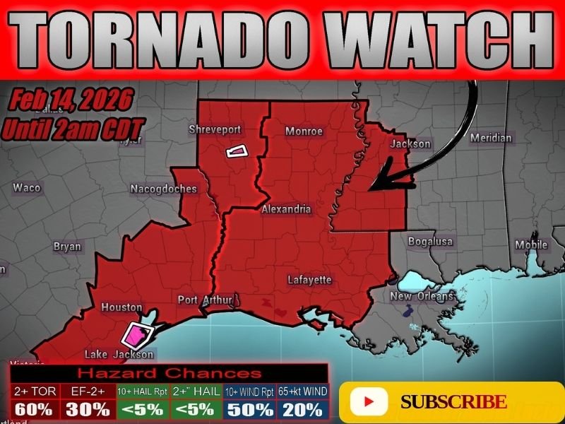
Tornado Watch Issued for Eastern Louisiana and Southwest Mississippi Until 2AM as Overnight Squall Line Pushes East with Rotating Storm Threat
LOUISIANA & MISSISSIPPI — A new Tornado Watch has been issued for eastern Louisiana and southwest Mississippi and will remain in effect until 2:00 AM CDT, as a powerful squall line continues pushing east overnight with the potential for embedded tornadoes.
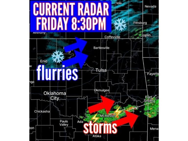
Forecasters warn that the line of storms is not done yet. Occasional circulations are expected to persist within the line as it moves across the region, keeping the tornado threat active through the late-night hours.
Watch Area Includes Major Cities Across Eastern Louisiana
The Tornado Watch covers a large portion of eastern Louisiana, including:
- Shreveport
- Monroe
- Alexandria
- Lafayette
- Areas eastward toward the Mississippi state line
Southwest Mississippi, including areas near Jackson, is also under the watch as storms track east.
The watch was issued for Saturday, February 14, 2026, and remains active until 2 AM CDT.
Hazard Breakdown: Tornado and Damaging Wind Threat
According to the hazard outlook provided with the watch:
- 60% chance of two or more tornadoes
- 30% chance of at least one strong (EF2+) tornado
- 50% chance of damaging wind gusts exceeding 65 mph
- Large hail risk appears low (<5%), but isolated hail cannot be ruled out
The primary concern overnight is damaging winds and brief, fast-moving tornadoes embedded within the squall line.
Overnight Threat Increases Danger
One of the most concerning aspects of this setup is timing. The storms will continue pushing east during the overnight hours when many residents are asleep.
Rain-wrapped tornadoes are possible within this line, making them difficult to see, especially in the dark. These types of tornadoes can develop quickly and provide little visual warning.
Residents in eastern Louisiana and southwest Mississippi should:
- Keep weather radios on
- Ensure emergency alerts are enabled on mobile devices
- Have a safe shelter location ready
- Avoid waiting for visual confirmation
Squall Line Continues East Into Early Morning
The squall line that triggered this watch will gradually shift eastward overnight, with rotating segments capable of producing brief tornadoes and strong straight-line winds. While not every community will experience severe impacts, the environment remains supportive of scattered tornadic circulations within the line.
Conditions are expected to gradually improve after the line exits east of the region early Sunday morning. Residents across the watch area should remain alert until the threat fully clears. Stay with SaludaStandard-Sentinel.com for continued updates on this developing severe weather situation.