Three-Day Severe Weather Threat Sets Up From Texas and Oklahoma to the Mississippi River Valley, With Friday Carrying the Highest Risk of Hail And Damaging Winds
UNITED STATES — A rare three-day stretch of severe weather risk is setting up across large portions of the central and southern United States, beginning late Wednesday night, continuing through Thursday, and intensifying further by Friday afternoon, according to forecast guidance highlighted in the latest outlooks.
The evolving pattern will start across Texas and Oklahoma, then shift eastward into the Mid-South and the Mississippi River Valley, with Friday shaping up as the most concerning day of the multi-day setup. Meteorologists stress that while not everyone in the risk zones will experience severe weather, conditions will remain favorable for isolated but potentially impactful storms each day.
Late Wednesday Night Into Thursday: Initial Severe Risk Develops
The first phase of this setup begins late Wednesday night into early Thursday morning, roughly between 12 a.m. and 6 a.m., primarily impacting parts of Texas and Oklahoma.
Forecast guidance highlights:
- Marginal (Level 1) severe risk
- Quarter-sized hail
- Isolated damaging wind gusts
At this time, no tornado threat is indicated for this initial overnight period. Storm coverage is expected to remain scattered, with severe impacts staying isolated rather than widespread.
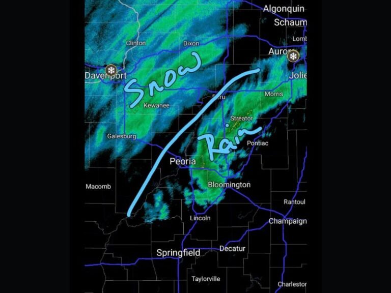
Thursday Night Into Friday Morning: Risk Shifts Eastward
As the system progresses, Thursday night into Friday morning brings a continued severe weather threat farther east, expanding into parts of the Mid-South region.
This phase still carries a Marginal (Level 1) risk, but meteorologists note that storm organization may improve, especially as moisture and instability increase ahead of the advancing system. Although severe weather is not expected to be widespread, localized damaging wind gusts and strong storms remain possible within the highlighted risk areas.
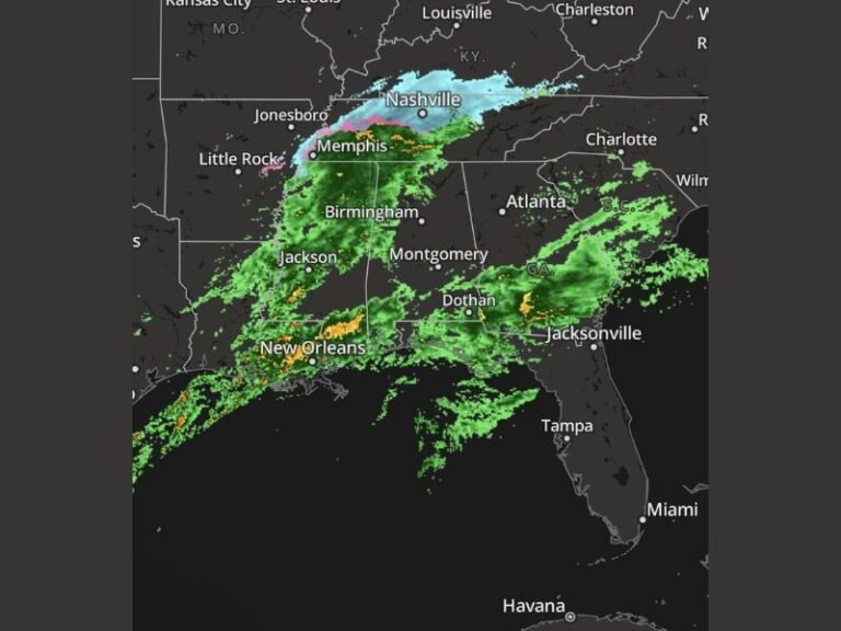
Friday Afternoon and Evening: Highest Threat of the Three-Day Period
Friday stands out as the main event of this multi-day setup. By Friday afternoon and evening, the severe weather threat shifts into portions of the Mississippi River Valley, where the Storm Prediction Center highlights a Level 2 (Slight Risk).
This area includes:
- Parts of Arkansas
- Northern Louisiana
- Western Tennessee
- Northern Mississippi
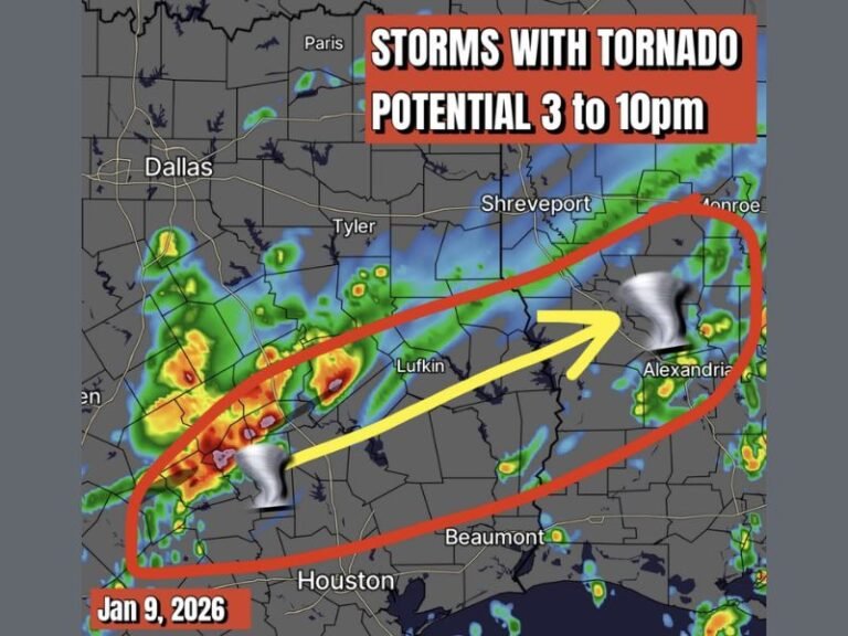
Friday’s threat includes:
- Isolated damaging winds
- The possibility of one or two tornadoes
- Strong to severe thunderstorms
Forecast models indicate that instability levels could increase, and meteorologists caution that any upward trend in instability could further raise the tornado risk.
Why Confidence Remains Cautious
Despite the multi-day setup, forecasters emphasize that this is not expected to be a widespread severe weather outbreak. Instead, severe storms are likely to remain scattered and localized, occurring within and near the highlighted risk zones.
The degree of storm intensity will depend heavily on:
- How much instability develops ahead of the system
- Storm timing relative to peak heating
- How storms interact with evolving atmospheric boundaries
What Residents Should Keep in Mind
Residents across the affected regions should:
- Monitor daily forecast updates
- Stay alert to changing risk levels
- Have a way to receive weather warnings, especially Friday
Even isolated severe storms can produce damaging winds, hail, or brief tornadoes, particularly during the highest-risk period on Friday.
Bottom Line
A three-day severe weather pattern will unfold from Texas and Oklahoma eastward into the Mississippi River Valley, beginning late Wednesday night and peaking on Friday, when the highest severe weather threat is expected. While widespread impacts are not anticipated, isolated severe storms remain possible each day, making continued awareness essential.
Stay with SaludaStandard-Sentinel.com for ongoing updates as this multi-day weather pattern continues to evolve.