Texas Storm Threat Tuesday Night: Dallas–Fort Worth to Del Rio Corridor Could See 2-Inch Hail, 70 MPH Winds and Isolated Tornadoes
TEXAS — A potentially active round of severe weather is expected to move across parts of West and North Texas Tuesday evening into early Wednesday morning, with forecasters warning of large hail, damaging wind gusts, and the possibility of isolated tornadoes.
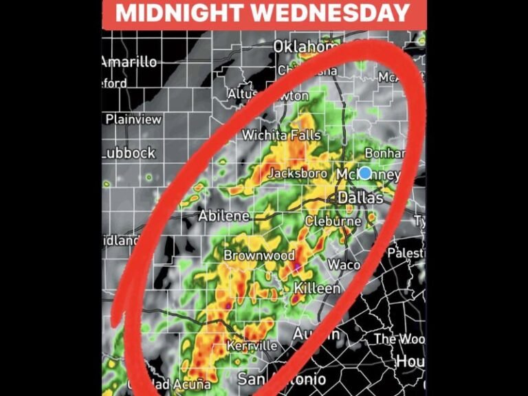
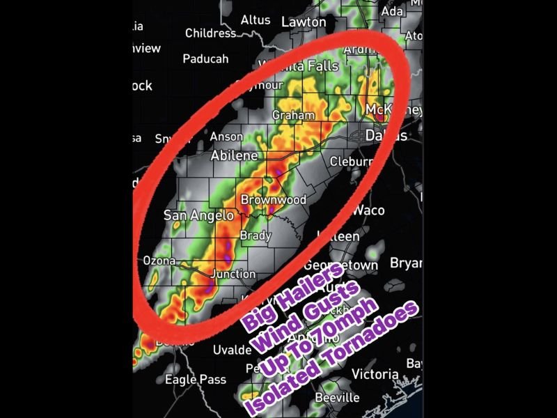
The Storm Prediction Center has placed a corridor from Del Rio through San Angelo and Abilene toward the Dallas–Fort Worth Metroplex under an Enhanced Risk for severe storms, signaling the potential for stronger thunderstorms during the evening hours.
Meteorologists say the system may organize into a squall line of storms, which could sweep across the region late Tuesday night.
Squall Line Expected to Develop Across West Texas
Forecast models show thunderstorms developing across West Texas during the late afternoon and evening, gradually forming a line that could move northeast toward North Texas overnight.
Communities along the storm track may include:
- Del Rio
- San Angelo
- Junction
- Brownwood
- Abilene
- Graham
- Wichita Falls
- Dallas–Fort Worth Metroplex
As storms organize into a line, the system could strengthen and produce widespread severe weather hazards.
Large Hail and Damaging Winds Possible
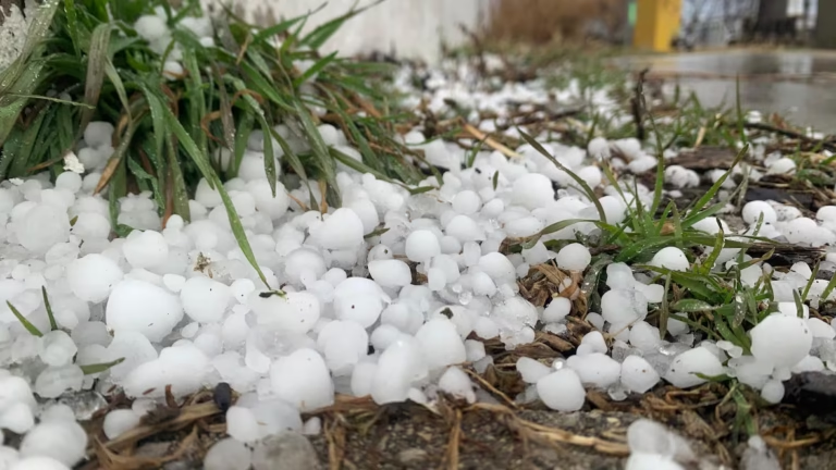
Forecasters warn that the strongest storms within the line could produce hail up to two inches in diameter, which is large enough to damage vehicles, roofs, and windows.
Another major concern will be damaging wind gusts reaching up to 70 miles per hour, which could knock down trees, damage structures, and cause scattered power outages.
Because squall lines can move quickly, storms may bring sudden bursts of intense wind and heavy rain as they pass through.
Isolated Tornado Risk Also Exists
Although the primary threat appears to be hail and damaging winds, meteorologists say isolated tornadoes cannot be ruled out, particularly in stronger rotating thunderstorms embedded within the line.
These tornadoes can sometimes develop quickly at night, making them more dangerous for communities that may not see the storms approaching.
Residents across North Texas are urged to stay alert for weather warnings and emergency alerts during the evening and overnight hours.
Strongest Storm Window Expected Tuesday Evening
Current forecasts suggest the most intense period of storms could occur between approximately 6 PM and 1 AM, beginning across West Texas and shifting toward North Texas later in the night.
Even after the strongest storms pass, scattered thunderstorms may continue into the early hours of Wednesday morning.
Because of the overnight timing, officials encourage residents to make sure they have multiple ways to receive weather alerts, especially while sleeping.
Stay with SaludaStandard-Sentinel.com for continuing updates as meteorologists track severe storms moving across Texas and the Southern Plains.