Texas, Arkansas, Tennessee, Alabama and Kentucky Hit by Nearly 1,000 Severe Storm Reports as Damaging Winds Sweep Across Midwest and South
UNITED STATES — A powerful storm system sweeping across Texas, Arkansas, Tennessee, Alabama, Kentucky and surrounding regions has generated nearly 1,000 severe weather reports since March 15, bringing widespread damaging winds and scattered hail, even as a feared tornado outbreak failed to fully develop.
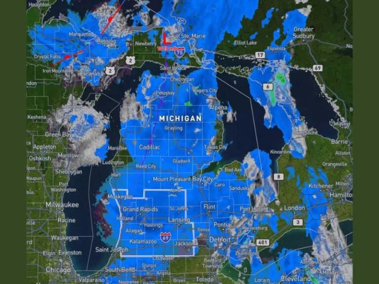
According to preliminary data from the Storm Prediction Center, the majority of reports were linked to a fast-moving squall line that intensified across multiple states, leaving behind a trail of damage and disruption.
Widespread Wind Damage Dominates Storm Reports
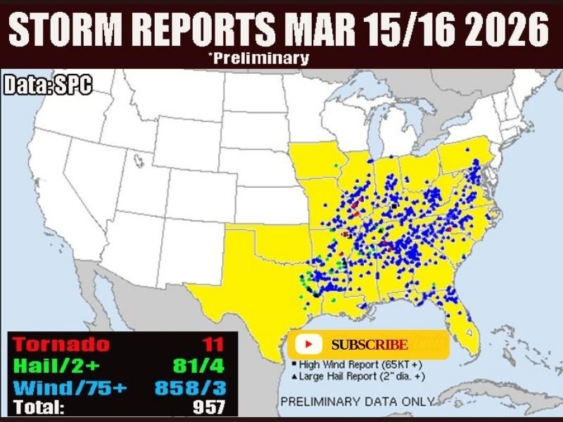
The latest preliminary report map shows a staggering concentration of severe weather incidents stretching from Texas through Arkansas, Mississippi, Tennessee, and into Kentucky and Alabama. The most dominant threat came from high winds, with over 850 reports of damaging gusts exceeding severe criteria.
Communities across these states reported downed trees, power outages, and structural damage as the squall line pushed eastward. Wind gusts exceeding 60 to 75 mph were common in many areas, creating hazardous conditions for travel and infrastructure.
Meteorologists noted that while the setup initially hinted at a more significant tornado outbreak, the system evolved differently, favoring widespread straight-line wind damage instead.
Tornado Activity Limited Compared to Expectations
Despite early warnings and atmospheric conditions that supported tornado development, only 11 tornado reports were logged across the affected regions. This is significantly lower than what forecasters had anticipated given the strength of the system.
Experts explain that while instability and wind shear were present, the storm structure consolidated into a linear system more conducive to damaging winds rather than discrete supercells capable of producing numerous tornadoes.
Still, isolated tornadoes did occur, and officials continue to assess damage in areas where brief touchdowns may have caused localized destruction.
Hail Reports Add to Severe Weather Impact
In addition to wind and tornado reports, there were over 80 reports of large hail, with some exceeding two inches in diameter. These hail events were scattered but contributed to property damage, particularly to vehicles, roofs, and crops in parts of the South.
The combination of hail and high winds made this system particularly dangerous, especially during peak evening hours when visibility was reduced and many residents were commuting or indoors.
Storm System Brings Nearly 1,000 Total Reports
Overall, the Storm Prediction Center logged approximately 957 severe weather reports during the March 15–16 period, underscoring the scale and intensity of the event.
This level of activity highlights how impactful squall line events can be, even without a major tornado outbreak. Widespread wind damage often affects larger geographic areas, leading to broader disruption compared to isolated tornado paths.
Conditions Expected to Quiet Down Temporarily
Following this intense outbreak of severe weather, forecasters say conditions are expected to calm down in the short term. The atmosphere across much of the affected region is stabilizing, reducing the immediate risk of additional widespread severe storms.
However, meteorologists caution that the spring severe weather season is far from over, and similar setups could emerge again in the coming weeks. Residents are encouraged to remain alert and prepared, especially as weather patterns continue to shift rapidly during this time of year.
If you experienced storm damage or severe weather in your area, share your story in the comments and stay updated with the latest reports on SaludaStandard-Sentinel.com.