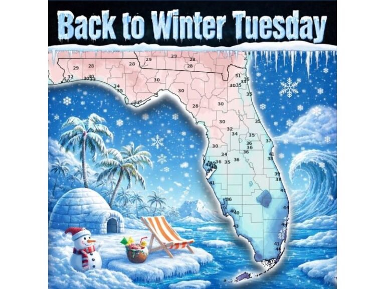
Tampa Bay Faces Rare Gulf-Effect Snow Flurry Setup as Arctic Air and Strong Winds Align Saturday Night
TAMPA, FLORIDA — Meteorologists are closely monitoring a rare and unusual winter weather setup that could allow brief snow flurries to develop near the Tampa Bay area late Saturday night as Arctic air surges south and interacts with warm Gulf waters.
While confidence remains modest and any snowfall would be light and short-lived, forecasters say the atmospheric ingredients are aligning just enough to warrant close attention along Florida’s central Gulf Coast.
Why Snow Flurries Are Even Possible Near Tampa Bay
The potential for snow hinges on a significant temperature contrast developing between the Gulf of Mexico and the air mass moving overhead. Forecasters note that water temperatures are expected to be roughly 40 degrees warmer than air temperatures around 5,000 feet above the surface — well above the typical threshold needed to generate instability.
This sharp contrast can allow moisture from the Gulf to rise rapidly, forming cloud bands capable of producing flurries if temperatures remain cold enough throughout the atmospheric column.
Strong Northwest Winds Create a Gulf-Effect Pattern
Another key factor is a prolonged fetch of strong northwest to north-northwest winds expected Saturday night. These winds would travel over the open Gulf waters before reaching the Tampa Bay coastline, providing enough time for moisture to be absorbed into the lower atmosphere.
This process resembles lake-effect snow seen in northern states, though on a much weaker and far rarer scale. Any snowflakes that develop would be light, scattered, and confined very close to the immediate coast.
Dry Air Aloft Remains the Biggest Limiting Factor
Despite the favorable temperature difference and wind direction, dry air in the upper levels of the atmosphere remains a major obstacle. Dry air can suppress cloud growth, preventing snow showers from fully developing.
Meteorologists stress that the chance remains small but real, with the outcome depending on whether low-level instability can overcome the dry air overhead during the overnight hours.
What Residents Should Expect Saturday Night
If flurries do occur, they would likely be brief, spotty, and most noticeable near the coastline rather than inland neighborhoods. No accumulation is expected, and many areas may see nothing at all beyond clouds and colder temperatures.
Regardless of snow chances, residents can expect an unusually cold night for late January, with brisk winds and temperatures well below seasonal averages.
Have you ever witnessed snow or flurries in Florida? Share your experience or observations with SaludaStandard-Sentinel.com as meteorologists continue tracking this rare winter setup.