Strong Arctic Front Expected Around January 10 as Forecast Models Signal Rapid Temperature Drops and High-Impact Wind Across the Southern U.S.
SOUTHERN UNITED STATES — Forecast guidance is signaling the potential for a strong Arctic front to push southward around January 10, bringing a sharp change in weather conditions across large portions of the southern and central United States. While the exact placement and intensity remain uncertain, the overall pattern shown in the data points to rapid cooling, increasing winds, and disruptive winter impacts rather than a gradual seasonal shift.
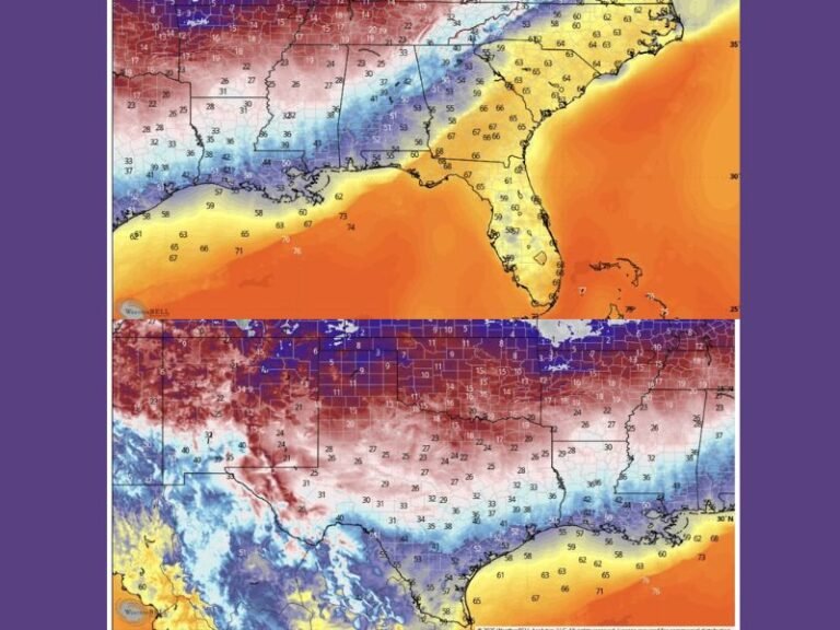
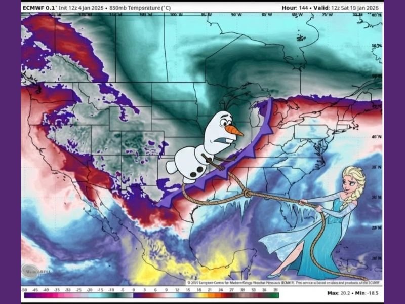
The model imagery highlights a pronounced temperature gradient, with much colder air surging southward behind a strong frontal boundary, while milder air remains briefly entrenched ahead of the system.
Forecast Models Show Aggressive Arctic Air Movement
The data displayed from the ECMWF model indicates a forceful push of cold air advancing south and east, with tightly packed temperature gradients that typically signal strong winds and rapid changes. These setups often produce conditions where temperatures fall quickly over a short period of time, especially once the front fully passes.
The graphic shows colder air dominating much of the central and northern U.S., with the boundary pressing toward the southern states. This suggests the system is not shallow or weak, but rather part of a broader large-scale winter pattern.
January 10 Timeframe Emerging as Key Window
Multiple references within the data point to January 10 as the most likely timeframe for the strongest impacts. At this range, forecasters are not focused on exact snowfall totals or precise city impacts, but instead on whether the pattern itself continues to show consistency.
At this point, guidance suggests a high-confidence signal for a strong frontal passage, even though finer details such as precipitation type, intensity, and exact track are still evolving.
Wind and Rapid Temperature Drops Are Primary Concerns
Based on the structure of the front and the spacing of temperature contours, wind is expected to be a major component of this system. Strong pressure differences across the boundary can lead to gusty conditions both during and after frontal passage.
Behind the front, temperatures are shown dropping sharply, indicating that cold air will not ease in gradually, but instead arrive quickly once the boundary moves through. These types of systems often catch people off guard due to how fast conditions deteriorate.
Winter Impacts Likely on the Cold Side of the System
On the colder side of the front, the data supports the potential for winter weather impacts, while areas ahead of the boundary remain warmer for a time. This sharp contrast is a hallmark of high-impact winter systems and reinforces the need for continued monitoring as the event approaches.
However, the model commentary clearly states this is not a storm to chase yet, but rather a signal worth watching to see if future model runs reinforce the setup.
Forecast Confidence Still Developing
Forecasters emphasize that this is an early signal, not a final forecast. While the overall pattern appears supportive of a significant winter push, additional model runs and ensemble agreement will be needed to increase confidence in specific outcomes.
For now, the takeaway is that a notable Arctic front is possible around January 10, with the potential for rapid temperature drops, strong winds, and winter impacts across parts of the southern U.S.
SaludaStandard-Sentinel will continue tracking this evolving setup and provide updates as forecast confidence improves.