South Carolina, North Carolina, Georgia and Alabama Face Tricky Overnight Rain-to-Snow Setup as Cold Air Chases Moisture Sunday Morning
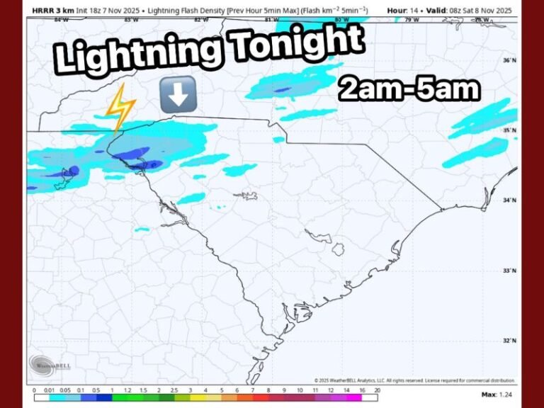
SOUTH CAROLINA — A fast-moving winter system is setting up a narrow but closely watched rain-to-snow scenario across parts of South Carolina, North Carolina, Georgia, and Alabama late Saturday night into Sunday morning, with meteorologists emphasizing that timing will determine who sees flakes and who sees just cold rain.
Based on the latest high-resolution model guidance and atmospheric sampling, this is shaping up as a low-impact but high-uncertainty winter event, driven by cold air surging in behind departing moisture. While this will not be a major snowstorm, it could deliver the first snowflakes many areas have seen in years, especially across favored corridors east and south of Interstate 85.
How the Setup Is Coming Together
Rain is expected to develop after midnight as temperatures hover near 40 degrees. As precipitation continues, evaporative and dynamic cooling may gradually lower surface temperatures toward the freezing mark. If that cooling happens quickly enough — particularly between 7 a.m. and 10 a.m. Sunday — rain could briefly change over to snow before moisture exits the region.
Forecasters describe this as a race against the clock: the earlier the changeover occurs, the better the chance for measurable snowfall. If cold air arrives too late, precipitation ends before snow can accumulate.
Where Snow Has the Best Chance
The most favorable zone currently extends south and east of I-85, where colder air may overlap lingering moisture. This includes parts of central and eastern South Carolina, southern North Carolina, and portions of eastern Georgia. Isolated “winner” areas could emerge between Columbia and Charlotte, where narrow deformation bands may briefly enhance snowfall.
Across the Upstate and foothill regions, snow chances drop sharply. Some locations may see no snow at all, while others could observe only a brief dusting if a final burst lines up just right.
Expected Amounts and Impacts
Most areas that do see snow are expected to receive a dusting to under one inch, with isolated pockets possibly reaching 1–2 inches if conditions align perfectly. Ground temperatures, terrain, and snowfall rate will play a major role in determining whether snow sticks or melts on contact.
Road impacts should be minimal overall. Pavement temperatures remain marginal, and most roads are expected to stay wet rather than icy. However, slick spots are possible on bridges, overpasses, and elevated surfaces where snow briefly accumulates.
Why Forecast Confidence Is Limited
This system is being driven by a small, fast-moving disturbance high in the atmosphere, making precise snowfall placement difficult. Even with enhanced model data from aircraft sampling, pinpointing where narrow snow bands set up remains challenging until the event is already underway.
Bottom Line
Snowflakes are likely to fly in parts of South Carolina, North Carolina, Georgia, and Alabama Sunday morning, but this is not a major winter storm. Many locations will see rain, some will see a quick mix, and a few may wake up to a light coating of snow. Most roads should remain passable, though early-morning travelers should stay alert for brief slick conditions.
The Saluda Standard-Sentinel will continue monitoring overnight trends and provide updates as newer model data becomes available.