Snow–Ice Battle Line Sharpens Across the Eastern U.S. as NWS Signals Heavy Snow North and Dangerous Freezing Rain South
UNITED STATES — The National Weather Service is refining its latest thinking on a major winter storm that will split the eastern United States into two very different impact zones, with heavy snow dominating the northern tier and a dangerous freezing-rain corridor setting up to the south. The latest guidance shows the most significant impacts aligning closely with the color-coded zones now coming into clearer focus.
Blue-shaded areas on the map indicate where snow will be the dominant precipitation, while red-shaded regions highlight where freezing rain is expected to be the primary hazard, with some mixing possible near the transition line.
Heavy Snow Expected North of the Transition Line
The snow zone stretches across the Ohio Valley, central and northern Appalachians, the Mid-Atlantic interior, and into parts of the Northeast, where colder surface and upper-level temperatures remain firmly in place.
States most likely to see significant accumulating snow include Ohio, Indiana, Pennsylvania, New York, West Virginia, and northern portions of Maryland and Virginia. In these areas, snow rates could become heavy at times, especially as the storm strengthens and moisture surges northward.
Travel disruptions, reduced visibility, and accumulating snow on untreated roads are expected to be the primary concerns in the blue-shaded region.
Freezing Rain Corridor Raises Ice Storm Concerns
South of the snow line, a broad swath of freezing rain is increasingly likely, stretching from parts of Arkansas and Tennessee through Kentucky, southern West Virginia, southern Virginia, and into North Carolina.
This red-shaded zone represents the most dangerous part of the storm, where surface temperatures hover near or below freezing while warmer air moves in aloft, creating ideal conditions for ice accumulation.
Even small shifts north or south could dramatically change local impacts, but current data suggests ice accretion could be significant enough to threaten trees, power lines, and infrastructure in these areas.
The Battle Zone Where Impacts Could Change Quickly
Near the dividing line between snow and freezing rain, some locations may experience both precipitation types, especially early or late in the event. These transition areas are the most sensitive to small temperature changes and may see rapid shifts between snow, sleet, and ice.
Forecasters emphasize that while the heaviest impacts are concentrated within the colored zones, lighter or mixed precipitation is still possible on either side of the boundary.
Why This Storm Demands Close Monitoring
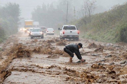
The sharp contrast between heavy snow to the north and freezing rain to the south makes this storm particularly challenging and potentially high-impact. Ice storms historically cause long-duration power outages, while heavy snow can paralyze travel and emergency response.
As the storm approaches, the National Weather Service will continue refining the exact placement of the snow–ice line, but confidence is growing that the most severe impacts will align closely with the current blue and red zones.
What Residents Should Do Now
Residents across the affected region should prepare based on their expected precipitation type. Those in snow-prone areas should plan for hazardous travel, while those in the freezing-rain zone should prepare for possible power outages, falling limbs, and prolonged recovery conditions.
Stay alert for forecast updates as even small adjustments in the storm track could shift impacts into new areas.
For continued storm tracking, impact analysis, and preparedness updates, follow ongoing coverage at SaludaStandard-Sentinel.com, where we will keep you informed as conditions evolve.