Sharp Temperature Divide Sweeps Across the South: Texas and Gulf States Experience Drastic Weather Contrast
DALLAS, TEXAS — Residents across the Southern United States are witnessing one of the most dramatic temperature splits of the season, as a strong cold front divides the region between winter-like chills in the west and spring-like warmth along the Gulf Coast.
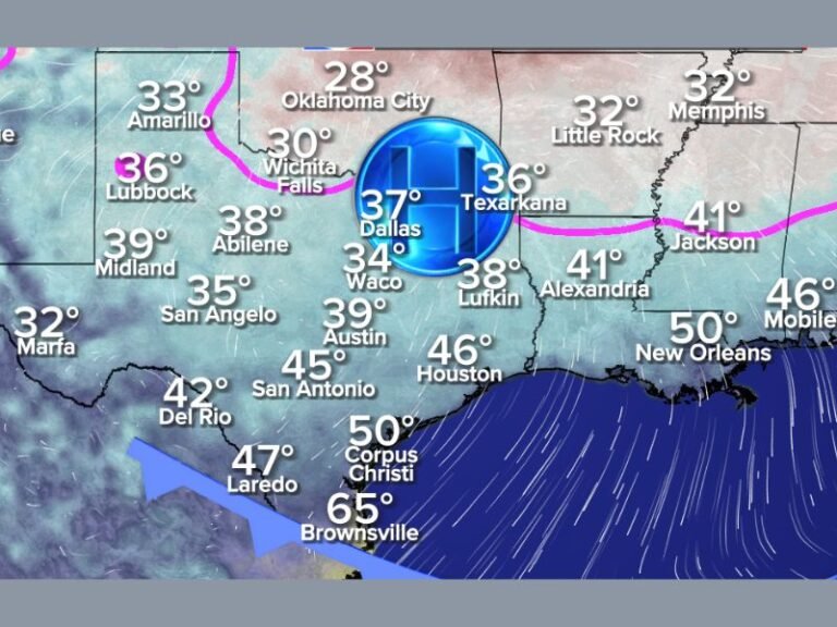
New model data and temperature maps reveal a stark thermal contrast, with readings in north and west Texas dropping into the 20s and 30s, while southern and coastal areas — including parts of Louisiana, Mississippi, Alabama, and Florida — remain in the 70s and even low 80s.
The result: half the South is bundled up in coats, while the other half is enjoying short sleeves and sunshine.
Texas Feels the Split Most Intensely
Meteorologists describe this as a “temperature whiplash” pattern, with a strong Arctic air mass pressing southward through Oklahoma, North Texas, and Arkansas, colliding with humid Gulf air that continues to linger along the coastline.
In Dallas–Fort Worth, temperatures are expected to hold steady in the mid-30s, while just a few hundred miles away in Houston, the mercury could reach the upper 60s to low 70s.
“It’s like two completely different seasons on the same map,” one forecaster said. “Texas is literally split between winter and early summer at the same time.”
The Cause: A Sharp Cold Front Meets Gulf Warmth
According to the WeatherBell Analytics temperature model, a powerful cold front is driving the temperature divide. Cold air is surging southward behind the front, with subfreezing temperatures as far south as Oklahoma and North Texas, while warm, moist air from the Gulf of Mexico continues to flow northward ahead of it.
The resulting temperature gradient is unusually steep — in some places, just a 200-mile span separates 40°F air from 75°F warmth.
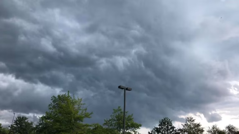
This dynamic clash of air masses has also triggered strong winds and unstable weather conditions, with gusts expected to exceed 30–40 mph in parts of Texas and the lower Mississippi Valley.
Regional Breakdown
- Texas: North and west regions in the 20s–30s; South Texas and Gulf Coast in the 60s–70s.
- Louisiana: Northern parishes cooling rapidly into the 40s, while southern areas remain in the 70s.
- Mississippi and Alabama: Divided zones — cool north, warm and humid south.
- Florida: Still holding in the 70s to near 80°, remaining unaffected by the northern chill — for now.
The wild contrast has been described by forecasters as a “thermometer mood swing”, a rare late-season clash between Arctic and tropical influences.
Impacts for Residents
This kind of sharp temperature shift can lead to fog, rain, and even thunderstorms along the dividing line. Drivers traveling north or west across the region could experience rapidly changing road conditions, as temperatures can drop 20 to 30 degrees within a few hours of travel.
Meteorologists also caution that heating demands will surge across the colder half of the South, while humidity and wind-driven warmth will persist closer to the Gulf.
“It’s not uncommon to see sharp divides like this in December,” experts said. “But the scale of this one — with nearly 50-degree differences across neighboring states — is impressive.”
Looking Ahead
The front is expected to continue moving eastward, gradually cooling the Gulf Coast states over the next 48 hours. However, Florida and parts of southern Alabama and Georgia will remain mild until midweek, when the Arctic air mass eventually sweeps through.
Residents should prepare for strong winds, rapidly dropping temperatures, and potential frost across northern areas once the front passes.
For continuous updates on weather patterns, temperature changes, and severe alerts across the South, stay with SaludaStandard-Sentinel.com — your trusted source for breaking weather coverage.