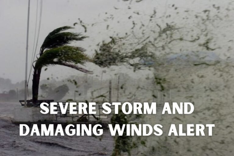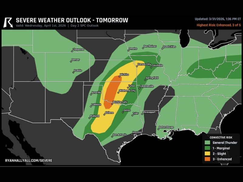
Oklahoma, Texas and Kansas Face Level 3 Severe Storm Risk With 2 Inch Hail and Tornado Threat Along I-35 Corridor
OKLAHOMA, TEXAS, KANSAS — A significant severe weather setup is taking shape across parts of the Southern Plains, with an upgraded Level 3 “Enhanced Risk” now in place for western Oklahoma, north Texas, and south-central Kansas heading into Wednesday.
Enhanced Risk Zone Targets I-35 Corridor
The latest outlook highlights a focused corridor of concern stretching from north Texas through western and central Oklahoma into southern Kansas. Cities along and near the I-35 corridor, including Wichita Falls, Oklahoma City, and areas near Wichita, fall within or close to the highest risk zone.
This Level 3 designation signals an increased likelihood of organized severe storms, including the potential for multiple hazards occurring at once.
Supercells Expected to Develop Along Dryline
Storm development is expected to begin late Wednesday afternoon along a sharp dryline positioned across western portions of the region. This boundary will act as the trigger for discrete supercells capable of rapidly intensifying.
These early storms are expected to be isolated at first, but conditions will favor strong updrafts capable of producing very large hail — potentially exceeding 2 inches in diameter.
Evening Transition Brings Wind and Tornado Threat
As storms track eastward into the evening and overnight hours, they are expected to grow in coverage and organization. This transition increases the threat from isolated supercells to a broader severe weather event.
Damaging wind gusts will become more prominent as storms cluster together, while the tornado risk may also increase, particularly as storms interact with favorable atmospheric conditions near and east of I-35.
Overnight Threat Extends Into Central Oklahoma and Kansas
The severe threat will not end after sunset. Instead, storms are forecast to push eastward overnight, maintaining intensity across central Oklahoma and into parts of Kansas.
Residents in these areas should remain alert well into the nighttime hours, as severe weather occurring after dark can be especially dangerous due to reduced visibility and delayed warnings.
Large Hail Could Be Primary Early Hazard
One of the most notable aspects of this setup is the potential for significant hail during the early phases of storm development. Supercells forming along the dryline will have the structure needed to support very large hailstones.
As storms evolve later in the evening, the focus may shift toward damaging winds and a possible uptick in tornado potential.
Residents Urged to Stay Weather Aware
With multiple hazards expected and storms continuing into the overnight hours, preparedness will be critical across Oklahoma, Texas, and Kansas.
Officials recommend ensuring that alerts are enabled on mobile devices and having multiple ways to receive warnings, especially during nighttime hours when storms may intensify. Severe weather events like this can evolve quickly, and conditions may change as new data becomes available.
Have you experienced severe storms in this region before or preparing for this event? Share your thoughts and stay updated with ongoing coverage at SaludaStandard-Sentinel.com.