Oklahoma Faces Rapid Weather Whiplash as Thursday Storms Give Way to Friday Snow Across the High Plains
OKLAHOMA — A fast-moving weather system is setting up a dramatic two-day weather reversal across Oklahoma, bringing strong thunderstorms, heavy rain, and gusty winds on Thursday, followed by a shift to winter conditions and accumulating snow in parts of the region by Friday.
Meteorologists describe the setup as a classic Southern Plains transition pattern, where warm, unstable air collides with an advancing cold front, allowing severe weather to develop first, before colder air surges in behind the system.
Thursday Brings Storm Zone Conditions to Much of Oklahoma
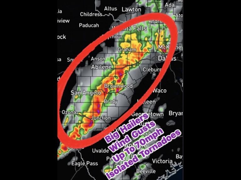
On Thursday, much of Oklahoma will sit squarely in the storm zone, particularly across central, eastern, and southern portions of the state, including areas near Oklahoma City, Tulsa, Stillwater, Enid, Bartlesville, and Wichita Falls.
Forecast guidance shows:
- Strong to severe thunderstorms
- Periods of heavy rain
- Gusty winds capable of causing travel and power disruptions
The combination of moist Gulf air and strengthening upper-level energy creates an environment favorable for organized storms, with lightning and brief intense rainfall likely in several areas. Officials urge residents with outdoor plans or Thursday travel to stay weather-aware, as conditions may deteriorate quickly once storms develop.
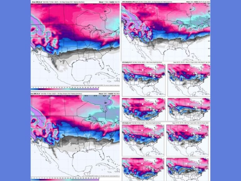
Cold Air Surge Triggers Snow Zone Shift by Friday
As the storm system exits, colder air will rapidly surge southward, pushing parts of the High Plains and northwest Oklahoma into the snow zone by Friday.
The transition zone shown on the map highlights snow potential spreading into areas north and west of the Oklahoma City metro, extending toward the Panhandle and nearby High Plains regions.
Key changes expected Friday include:
- Rain changing to snow in colder zones
- Falling temperatures
- Potential travel impacts, especially during the morning and midday hours
While not all areas will see snow, the sharp contrast between Thursday’s storms and Friday’s winter conditions underscores how quickly weather can change in Oklahoma.
Why This Setup Is Typical — and Dangerous — for the Southern Plains
This pattern is textbook Oklahoma weather, where:
- Thunderstorms occur one day
- Winter precipitation follows the next
- Forecast confidence improves only hours before impact
These rapid shifts can catch drivers and travelers off guard, especially if road conditions change overnight. Even light snow following heavy rain can lead to slick roads, reduced visibility, and delayed commutes.
What Residents Should Prepare For
Meteorologists stress preparation over panic. Residents should:
- Monitor updated forecasts through Thursday night
- Plan flexibility for Friday morning travel
- Secure outdoor items ahead of gusty winds
- Be ready for colder temperatures following storms
Winter may have teased warmer conditions recently, but this setup is a reminder that cold air still has influence across the Plains.
As forecasters note, winter is not finished yet, and Oklahoma’s ability to experience multiple seasons in a matter of days remains firmly intact. Stay with SaludaStandard-Sentinel.com for continued updates as timing, impacts, and snow placement become clearer over the next 24 hours.