Ohio, Michigan, Indiana, and Illinois Preparing for Sharp Post-Christmas Arctic Blast as Temperatures Plunge Into the Teens
MIDWEST — A sharp surge of Arctic air is expected to sweep across Ohio, Michigan, Indiana, and Illinois shortly after Christmas, ushering in significantly colder temperatures and the potential return of lake-effect snow for parts of the Great Lakes region. Forecasters say this pattern flip will arrive quickly, ending what has been the mildest stretch of December for many areas.
Arctic Air Mass Expected to Drop Temperatures Dramatically
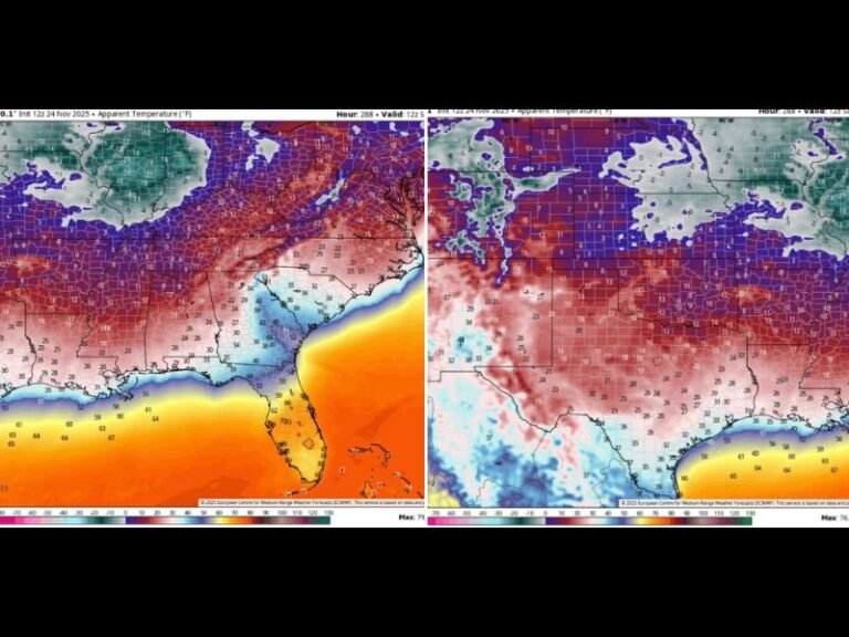
Meteorologists are tracking a strong cold front that will push south from Canada early next week, delivering the first true blast of mid-winter air for much of the Midwest. Forecast guidance shows afternoon highs falling into the teens across Ohio, with single digits likely farther west in Illinois and parts of Indiana. Northern Michigan could experience subzero readings, particularly during overnight periods.
This system marks a sharp departure from the current weather pattern, which has produced above-normal temperatures and easy holiday travel conditions across the region.
Mild Holiday Travel Period Before the Pattern Flips
Before the cold arrives, residents will enjoy what forecasters describe as the mildest stretch of the month, with no major storm systems expected to disrupt Christmas travel. Roads are projected to remain mostly dry, and temperatures will remain well above freezing through Christmas Day across all four states.
Meteorologists note that this calm period may make the upcoming blast feel even more jarring as temperatures drop rapidly once the cold front sweeps through.
Lake-Effect Snow Likely to Restart Downwind of the Great Lakes
Once the Arctic air settles in, the lake-effect snow machine may reactivate, particularly along the eastern shores of Lake Michigan and Lake Erie. While exact snow totals remain uncertain, early indications suggest localized bands could redevelop, bringing bursts of snow to typically vulnerable communities.
Forecasters emphasize that lake-effect activity will depend on the precise timing of the coldest air and the strength of the northwest flow that follows the frontal passage.
Residents Urged to Prepare for a Sudden Shift
Wind chills may dip well below zero in some areas, especially during early morning hours. The abrupt temperature drop could also create slick spots on untreated roadways as residual moisture freezes. Residents are encouraged to plan for hazardous wind chills, reheating needs, and the potential for brief periods of blowing snow. Additional model updates are expected as the system organizes. For continuous weather coverage and developing forecasts, visit SaludaStandard-Sentinel.com.


