North Carolina Temperatures Drop Into the 40s and 50s Monday as Low Pressure Brings Widespread Clouds, Scattered Showers and Early Freezing Drizzle in the Mountains
NORTH CAROLINA — A noticeable shift in weather is expected Monday as temperatures fall 20 to 30 degrees cooler across much of the state, bringing highs down into the 40s and 50s to start the workweek.
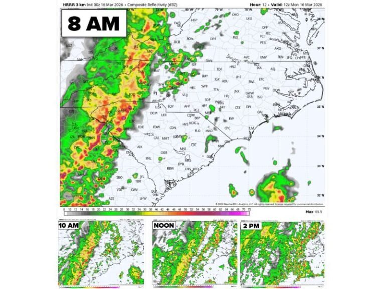
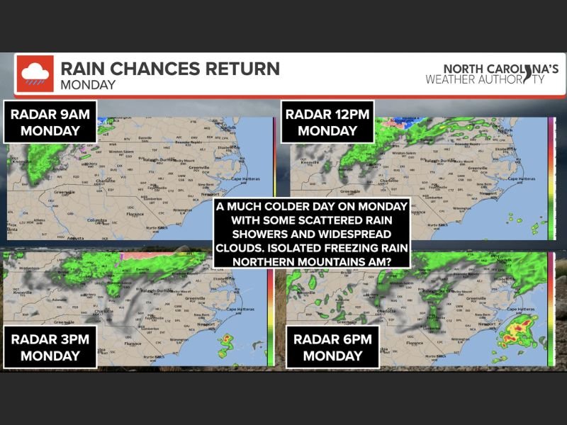
Forecasters say a low-pressure system will pass north of the state into Virginia, but its influence will still be felt across North Carolina with widespread cloud cover and scattered showers throughout the day.
Colder Air Moves In Statewide
After recent milder conditions, Monday’s temperatures will feel significantly cooler. Most communities across central and eastern North Carolina will remain cloudy and chilly with occasional light rain or drizzle.
Radar projections show scattered precipitation moving through during the morning hours, with additional showers possible into the afternoon and early evening.
Freezing Drizzle Possible in Northern Mountains
While the majority of the state will simply deal with cold, damp conditions, the northern mountains and High Country could see a brief period of light freezing drizzle early Monday morning.
Temperatures in those higher elevations may hover near or slightly below freezing before gradually rising above 32 degrees later in the morning. Any icy glaze is expected to be light and limited primarily to elevated surfaces such as bridges and untreated roads.
Officials note that widespread winter impacts are not anticipated, but travelers in mountainous areas should remain cautious during the early morning commute.
Showers Continue Into the Afternoon
By midday and into the afternoon, scattered showers will continue moving across portions of the state as the low-pressure system tracks into Virginia. Cloud cover is expected to remain widespread through much of the day.
Evening radar trends suggest lingering light rain in some areas before conditions gradually begin to improve overnight.
Residents are advised to prepare for a chilly, gray start to the week and allow extra travel time if driving through mountain regions early Monday.
How are conditions in your area? Share updates and photos with us at SaludaStandard-Sentinel.com.