North Carolina Faces Midday Snow Band Across the Piedmont as Fast-Moving Winter System Targets I-85 Corridor
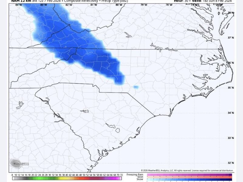
NORTH CAROLINA — A fast-moving winter weather system is expected to bring a narrow band of snow across central North Carolina Sunday afternoon, with impacts focused along the Piedmont and portions of the Interstate 85 corridor.
Forecast guidance shows snow developing around midday and moving quickly east, creating a short but potentially disruptive window for travel and outdoor activity.
Snow Band Targets Piedmont Region
Model data indicates a concentrated stripe of snow forming across the western and central Piedmont before pushing eastward. While the event is expected to be brief, the intensity within the band could allow snow to accumulate quickly in localized areas.
Communities along and near I-85 are most likely to experience snow, while areas farther east may see lighter impacts or little accumulation.
Timing Centers on Sunday Afternoon
The snow is expected to arrive as temperatures hover near freezing, increasing the risk of slick road conditions even with limited accumulation. Because the system moves through during daylight hours, sudden changes in road conditions could catch drivers off guard.
Forecasters emphasize that this is not a prolonged winter storm, but rather a quick-hitting event that could still disrupt travel during its passage.
Travel Impacts Possible Despite Short Duration
Even a brief burst of snow can create hazardous driving conditions, especially in a region less accustomed to winter weather. Untreated roads, overpasses, and elevated surfaces may become slippery as snow falls.
Officials urge drivers to use caution during the afternoon hours and remain alert for rapidly changing conditions.
Typical Late-Winter Pattern for the Region
Meteorologists note that this type of narrow, fast-moving snow band is common in late winter across the Carolinas, when cold air briefly overlaps with passing systems.
While widespread disruption is not expected, the setup highlights how quickly winter weather can develop even when confidence in major accumulation remains low.
Have you seen snow move through your area today? Share what conditions were like where you live at SaludaStandard-Sentinel.com, where we continue tracking developing weather across North Carolina and the Southeast.