North Carolina Could See Another Midweek Rain-to-Sleet or Snow Switch Near Raleigh and Greensboro, With Black Ice Risk Early Tuesday
NORTH CAROLINA — Another round of winter-weather chatter is building across the state, and while forecasters stress this won’t be a major winter storm, there is high-uncertainty potential for light snow or sleet midweek—especially in Northern and Central North Carolina, with the most favored area north of Raleigh and Greensboro.
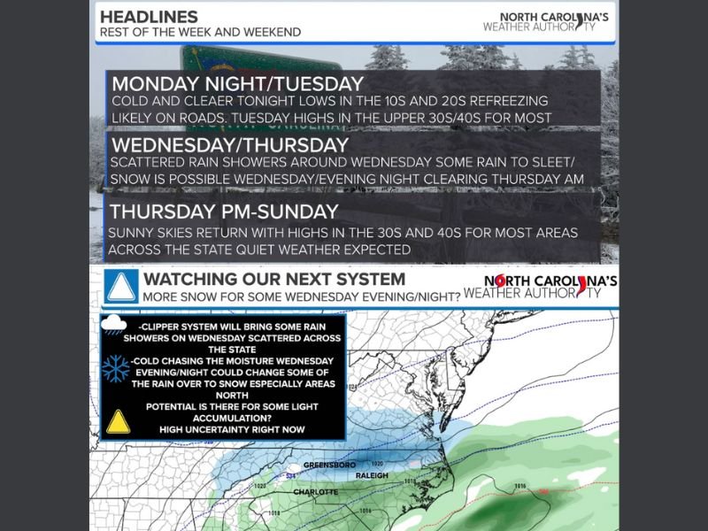
Monday Night Into Tuesday: Refreeze and Black Ice Concerns
Forecast messaging for the start of the week focuses less on snow and more on what happens overnight. Lows are expected to dip into the 10s and 20s across North Carolina, which means any leftover moisture on roads, sidewalks, and parking lots can refreeze by morning.
That raises the risk for black ice, especially in shaded areas, on bridges and overpasses, and in spots that didn’t fully dry out from prior precipitation. Even when roads look clear, a thin glaze can create slick conditions during the early commute. Temperatures should rebound Tuesday afternoon, with highs trending into the upper 30s and 40s for most areas as clouds increase from west to east.
Wednesday and Thursday: A Clipper Brings Rain First
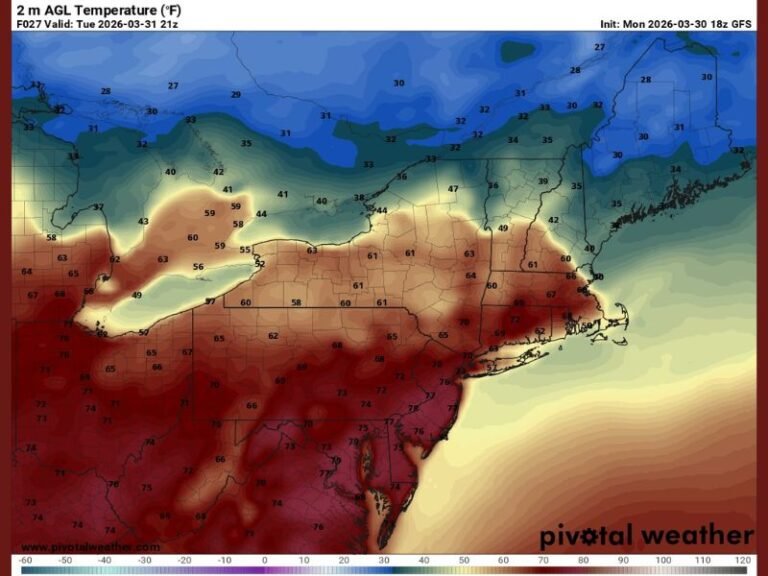
The midweek system being watched is described as a clipper approaching from the west. The expectation right now is that scattered rain showers move into the state Tuesday night into Wednesday, and that most of the daytime period Wednesday stays primarily rain because temperatures should be mostly above freezing while the moisture arrives.
At this stage, the forecast emphasis is on a wet but generally non-extreme event for much of the state—more nuisance rain than a true winter weather outbreak. Still, the timing of cold air catching up to the moisture is the piece that could shift the story late Wednesday.
Wednesday Evening Into Overnight: Where Snow or Sleet Could Sneak In
Forecasters note that things become “more interesting” late Wednesday into the overnight hours because the low-pressure system slows down and a colder push tries to catch up. If the cold arrives at the right moment, some rain could change over to sleet or wet snow, mainly across Northern and Central North Carolina.
The favored corridor highlighted in the discussion focuses especially north of Raleigh and Greensboro, where temperatures may cool just enough late Wednesday night to support a brief wintry mix. Any accumulation, if it occurs, would likely be light and slushy/wet, rather than powdery snow—because temperatures are expected to be relatively mild compared to classic snow setups.
Travel Impact Window: Thursday Morning Is the Main Concern
If a rain-to-sleet/snow changeover happens, the most likely time for minor travel issues would be early Thursday morning, when the overnight period aligns with colder air and lower visibility. That said, forecasters are careful to stress this is not a “slam dunk” scenario. Cold air chasing moisture often fails when the system exits too quickly or temperatures don’t drop fast enough.
Several models are reportedly showing some version of the changeover, which is why it’s being mentioned now—but the overall message is no panic, and that the state will be watching the next 24–48 hours for clearer confidence.
Thursday Afternoon Through Sunday: Quiet Weather Returns
After the system clears, the outlook turns calmer. Sunshine is expected to return, and the pattern appears quiet heading into the weekend, though still chilly overall. Highs are forecast to stay largely in the 30s and 40s across the state, with some modest warming at times but no major storm signal in the immediate period.
Bottom Line: Not a Storm, But Not Zero Either
The current forecast leans toward a mostly rain event with a nonzero chance of light sleet/snow for parts of North Carolina late Wednesday into early Thursday—particularly north of Raleigh and Greensboro. Add in the refreeze risk Tuesday morning, and it’s understandable why “snow fatigue” is setting in across the state. Still, forecasters say this is a limited-moisture system and any wintry impacts would likely be spotty and minor if they occur at all.
Are you seeing slick spots or refreeze issues where you live—and do you think the midweek changeover actually happens this time? Share what you’re noticing and join the conversation at SaludaStandard-Sentinel.com.