New England Braces for Multi-Day Winter Storm as Snow and Ice Focus Shifts North Into Maine Through Monday
NEW ENGLAND — A long-duration winter weather system is expected to impact parts of New England from Saturday through Monday, with forecasters warning that northern Maine could see the most persistent and disruptive conditions as the storm evolves into a coastal system. Meteorologists say the setup is dynamic, with precipitation types and impacts changing as the system moves east and north through the region.
Rain Starts in Southern New England Before Precipitation Changes
Forecast guidance indicates that rain will begin Saturday afternoon across southern New England, including areas of Massachusetts, Rhode Island, and Connecticut. However, this initial rainfall is expected to be short-lived, lasting only several hours before the system pushes northward. As temperatures cool and the storm strengthens, precipitation will begin transitioning farther inland.
Snow and Mixed Precipitation Increase Saturday Night
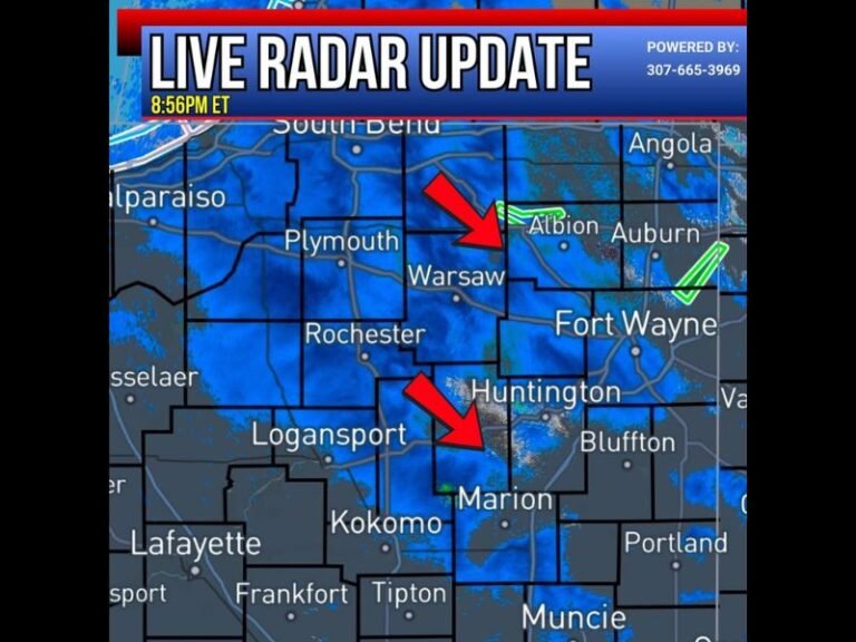
By Saturday evening and overnight, snow and mixed precipitation are expected to expand across central and northern New England, including parts of New Hampshire, Vermont, and interior Maine. Forecasters caution that icing conditions may develop late Saturday night into early Sunday, especially in areas where surface temperatures hover near freezing. Travel conditions could deteriorate quickly during this transition period.
Storm Focus Shifts Into Northern Maine Sunday Into Monday
As the system progresses through Sunday, the heaviest and most persistent precipitation is expected to concentrate over northern Maine, where snow could continue into Monday morning. This prolonged period of precipitation raises concerns for significant snowfall totals in far northern parts of the state. Snow showers may also linger elsewhere across northern New England, adding additional accumulation from central New Hampshire and Vermont northward.
Potential Coastal Development in the Gulf of Maine
Meteorologists are also monitoring a secondary area of low pressure expected to move into the Gulf of Maine on Sunday morning. While this feature may attempt to strengthen, current forecasts suggest it will have minimal additional impact on New England, instead favoring stormy conditions for the Canadian Maritimes. Still, forecasters say this feature bears watching as models refine its track and intensity.
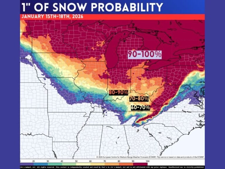
Snow Accumulation Outlook Varies Widely by Location
Early snowfall projections show a sharp gradient across the region, with lighter totals in southern New England and steadily increasing accumulations moving north, particularly in northern Maine, where the longest-duration snow is expected. Officials urge residents to stay alert for updated forecasts as snowfall totals and icing potential become clearer.
What to Expect Next
Meteorologists say more clarity is expected with updated model data, especially regarding ice risk and final snow totals. Residents across New England — particularly in Maine, New Hampshire, and Vermont — are encouraged to prepare for winter travel disruptions and changing conditions through the weekend. Have you begun preparing for the upcoming storm in your area? Share your plans and stay informed with continued coverage at SaludaStandard-Sentinel.com.