Mississippi, Alabama, and Louisiana Could See Early Taste of Winter as December 17 Brings Sharp Temperature Drop and Possible Sleet
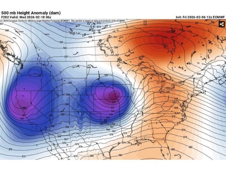
MISSISSIPPI — Winter may be showing up early across parts of the Deep South this year, as meteorologists warn that Mississippi, Alabama, and Louisiana could experience an unusual mid-December temperature plunge and even light sleet around December 17. The latest long-range forecasts reveal a dramatic cold-air anomaly sweeping across the region, sending temperatures as much as 20 degrees below normal and possibly producing short bursts of wintry precipitation.
Weather models from WeatherBell Analytics and the National Weather Service show a striking divide forming across the Southeast — with the Gulf Coast states plunging into Arctic chill while Florida stays relatively warm. Experts are calling this one of the most significant early-winter pattern changes of the season.
Cold Front to Sweep Across the Deep South
Forecast maps indicate that by mid-December, daytime highs across Mississippi and Alabama could struggle to climb out of the 30s and 40s, with overnight lows dipping near freezing. The cold surge will be accompanied by strong winds, a sharp drop in humidity, and a potential for “sleet sprinkles” or icy patches across parts of central Mississippi and southern Alabama.
In some projections, localized sleet totals up to 0.3 inches appear possible in parts of southern Mississippi and western Alabama, creating a thin glaze on bridges and elevated roadways. Louisiana’s northern parishes could also experience brief wintry precipitation, though forecasters stress that accumulations are expected to remain minimal.
Meteorologists say this event is not yet classified as a major winter storm, but it represents an early sign of volatile December weather. “This isn’t a snowmageddon scenario,” one forecaster explained. “It’s more of a heads-up that cold air and Gulf moisture are starting to line up in ways that could bring brief icy surprises.”
Experts Urge Caution and Close Monitoring
Weather experts are advising residents across the Gulf Coast and Deep South to monitor local forecasts closely in the coming days. Even minor wintry precipitation can cause slick road conditions in areas not used to freezing rain or sleet.
Officials also urge homeowners to take basic cold-weather precautions — including protecting pets, plants, and exposed water pipes — as the strong front moves in.
The National Weather Service has hinted at an elevated probability of below-normal temperatures from December 15 to 20, lining up with model runs showing Mississippi, Alabama, and Louisiana directly under the coldest air mass.
Southern States Brace for Weather Whiplash
The dramatic temperature contrast has sparked both concern and humor online, as residents prepare for what one social media post called “Mother Nature seasoning the South with a little chaos dust.”
While much of Florida may remain comfortably mild, the neighboring states could experience “Netflix-level drama” in the skies as cold air battles Gulf warmth — creating a narrow but potent zone for sleet or freezing drizzle.
Meteorologists describe this as the kind of setup that “might not break records but could certainly catch drivers off guard.”
What to Expect Next
As the December 17 date approaches, forecast confidence will improve, and meteorologists will refine details about where sleet or icy rain might fall. For now, the key takeaway is that Mississippi, Alabama, and Louisiana should prepare for a sudden and sharp shift to winter-like conditions.
Residents are encouraged to:
- Check updated forecasts daily leading up to December 17.
- Keep emergency kits in vehicles in case of icy travel.
- Stay indoors during freezing overnight hours when possible.
The system remains several days away, but all indications point to the Deep South’s first significant winter jolt of the season.
For ongoing updates and regional weather alerts, follow SaludaStandard-Sentinel.com.


