Midwest, Southeast, and Eastern U.S. Brace for Sharper Cold and Strong Winds as Pattern Shifts January 15–18
UNITED STATES — Weather pattern data for January 15 through January 18 shows a significant atmospheric shift developing across the Midwest, Southeast, Appalachians, and Eastern United States, replacing recent mild conditions with colder air, increasing winds, and a more wintry feel.
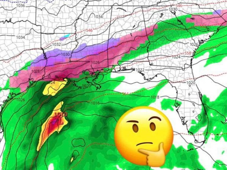
The change is driven by a strong ridge building over the western U.S. and a deepening trough across the central and eastern states, a classic setup that allows cold Canadian air to surge southward.
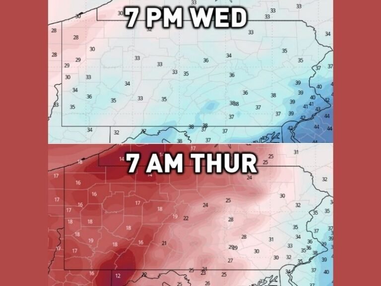
Cold Air Expands Into Central and Eastern States
Temperature anomaly maps show below-average temperatures spreading from the northern Plains into the Midwest, then pushing east and south into:
- Illinois, Indiana, Ohio, Michigan
- Kentucky, Tennessee
- West Virginia, Pennsylvania
- Portions of the Mid-Atlantic and Southeast
While this does not signal a historic freeze, it does indicate a noticeable step down from recent warmth, with colder mornings and reduced daytime highs becoming more common.
Windy Conditions Likely as Trough Deepens
Upper-air pattern maps highlight tight pressure gradients across the eastern half of the country, which typically translate to gusty surface winds. As the trough strengthens, residents across the Midwest, Ohio Valley, Tennessee Valley, and interior Southeast may experience persistent breezes and periodic stronger gusts, especially as colder air moves in behind passing systems.
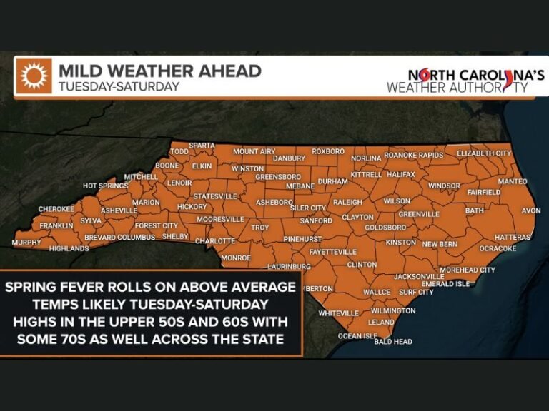
Recent Mild Weather Gives Way to a More Typical January Feel
The data does not suggest continuous snow or extreme cold for all locations. Instead, it points toward:
- Fewer warm, spring-like afternoons
- Colder overnight and early-morning temperatures
- Increased wind chill effects
- A return to seasonal January conditions
Southern states may feel the contrast most sharply after an extended stretch of warmth.
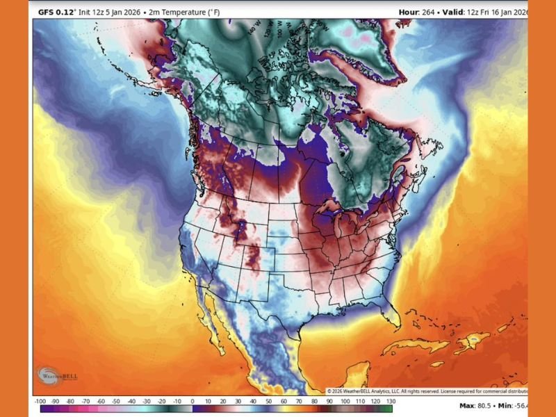
What This Pattern Change Means Going Forward
This type of setup often opens the door for additional systems later in the month, though specific storm tracks and precipitation types cannot yet be determined.
At this stage, the most confident signals are:
- A colder air mass dominating the eastern U.S.
- Increased wind potential
- Higher confidence in a sustained pattern change rather than a brief cooldown
Residents should be prepared for sharper cold, windier days, and a more unsettled winter atmosphere as mid-January approaches. Stay with SaludaStandard-Sentinel.com for continued updates as confidence increases and regional impacts become clearer.