Midwest and Southern Plains Brace for Tuesday Tornado Threat as Illinois, Missouri and Indiana Sit in Highest Risk Zone
UNITED STATES — A significant severe weather setup is expected to unfold Tuesday across parts of the Midwest and Southern Plains, where forecasters say tornadoes, large hail, and damaging storms may develop across several states.
Meteorologists warn that the region could experience another round of severe weather only days after a previous storm threat, raising concern for communities across the central United States.
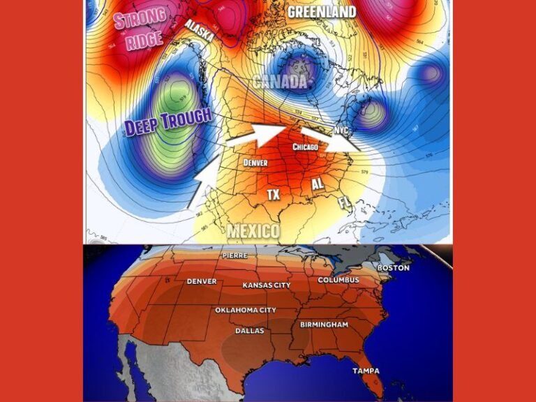
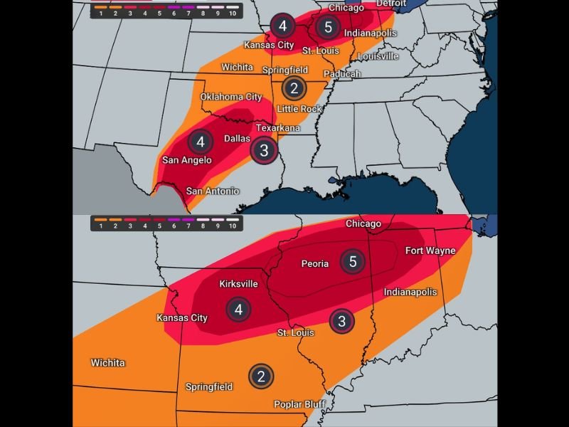
Forecast guidance shows the highest tornado risk centered across portions of Illinois, Missouri, and Indiana, with additional threats stretching south into parts of Arkansas, Oklahoma, and Texas.
Highest Tornado Potential Focused on Midwest
Weather outlook maps highlight a corridor of enhanced tornado risk extending from Missouri into central Illinois and western Indiana, where atmospheric conditions may become particularly favorable for rotating thunderstorms.
Some forecast models place the highest tornado probability directly across areas including St. Louis, Peoria, and Indianapolis, where the strongest storms could develop during the afternoon and evening hours.
Meteorologists note that tornado activity at this level of risk is unusual for early March, making the developing system one that forecasters are monitoring closely.
Tornado Risk Extends Into the Southern Plains
The severe weather threat will not be limited to the Midwest. Forecast data also shows elevated tornado potential across parts of the Southern Plains, including Oklahoma and portions of north Texas.
Cities such as Oklahoma City, Dallas, and San Angelo could experience severe thunderstorms capable of producing tornadoes as the system tracks eastward.
However, meteorologists say the strongest tornado potential may remain focused farther north where atmospheric energy and wind shear are expected to overlap more significantly.
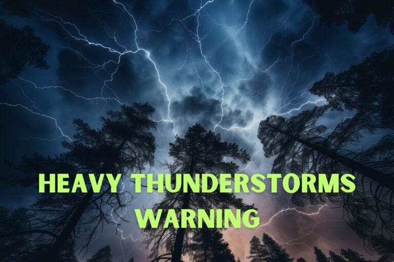
Large Hail and Damaging Storms Also Likely
Along with tornadoes, forecasters warn that very large hail could accompany the strongest thunderstorms.
Some storms may produce hailstones two inches in diameter or larger, which can cause significant damage to vehicles, roofs, and windows.
Strong thunderstorms may also bring damaging wind gusts capable of knocking down trees and power lines, especially in areas where storms organize into larger clusters.
Residents Urged to Prepare Ahead of Time
Because severe weather can develop quickly, meteorologists are urging residents across the risk zone to identify safe shelter locations before storms arrive.
Officials emphasize that mobile homes are not safe during tornado warnings, and residents should plan ahead to find sturdier shelter if needed.
People are also encouraged to ensure they have multiple ways to receive weather alerts, including smartphone warnings and NOAA weather radios. Forecasters expect to provide additional updates Tuesday morning as the storm system develops.
Stay with SaludaStandard-Sentinel.com for continuing coverage as meteorologists track the severe weather threat across the Midwest and Southern Plains.