Michigan and Ohio Ice Storm Threat Builds Ahead of Valentine’s Day as Arctic Cold Lingers and Freezing Rain Risk Grows
MICHIGAN — A stubborn arctic air mass hanging over the Great Lakes could set the stage for a messy winter mix next week, with forecasters warning that ice may become a real concern as Valentine’s Day approaches—especially across southern Michigan and northern Ohio, where cold air near the ground can trap freezing temperatures even as warmer air tries to move in above it.
Why This Setup Can Produce Freezing Rain and Ice
Forecasters say the key issue is that the cold air has been in place long enough to become “stubborn.” When that happens, temperatures near the surface can stay at or below freezing while a warmer layer develops overhead. That is the classic recipe for freezing rain and sleet—precipitation that starts as rain aloft but freezes on contact with roads, trees, and power lines.
Instead of a straightforward snow event, this creates the kind of storm that can look manageable on radar but quickly turns dangerous on untreated surfaces.
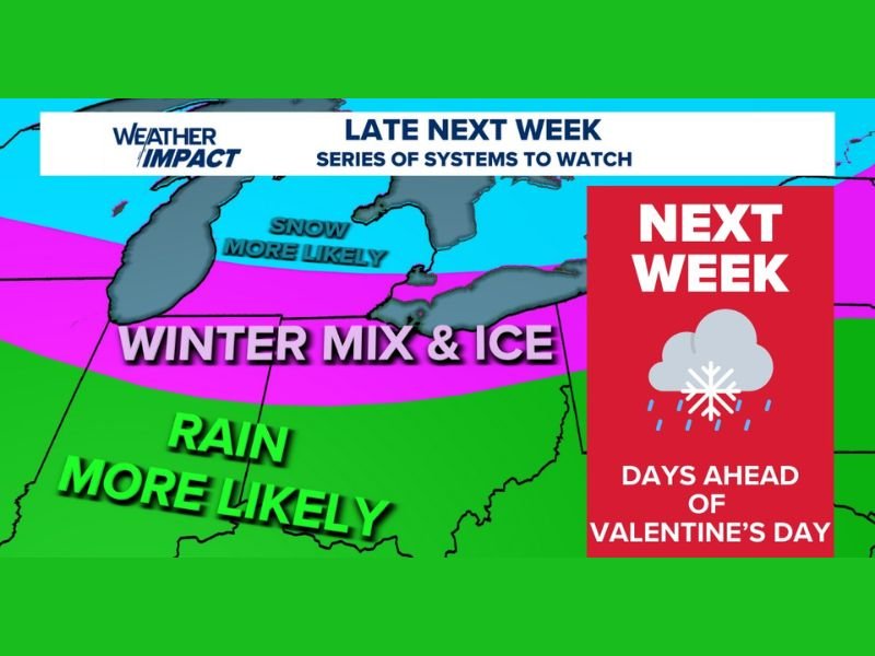
Where Winter Mix and Ice Look Most Possible
The map included with the update highlights a broad winter mix and ice zone stretching across parts of the Great Lakes region, while also showing that rain may be more likely farther south and snow more likely farther north.
The highest concern area called out in the written update is northern Ohio and southern Michigan, where the battle line between warmer air and lingering surface cold could be tight enough to produce prolonged icing.
Past Ice Events Raise Concern About Power Outages
The forecast discussion notes that similar patterns in previous years have produced heavier icing, including one event in southern Michigan that triggered widespread power outages. Forecasters stressed it is too early to say whether this next week setup will reach that level, but the ingredients are close enough that it’s time for residents to start paying attention.
Ice is often the most disruptive winter hazard because even small amounts can weigh down tree limbs and power lines, while also making roads nearly impossible to treat effectively during active freezing rain.
Timing: “Late Next Week” and Multiple Systems to Watch
The graphic labels the threat window as late next week, describing it as a “series of systems to watch.” That matters because repeated waves can reinforce cold air and increase the risk that at least one round falls as freezing rain instead of plain rain.
With Valentine’s Day travel and plans often falling into the same timeframe, forecasters are urging people to keep flexibility in mind and watch how the temperature profile evolves over the next several days.
Are you in Michigan or Ohio, and have you experienced major icing in your area before? Share what you’re seeing and how you prepare, and keep following updates at SaludaStandard-Sentinel.com.