Massive 2,000-Mile Severe Storm Zone Erupts Across the U.S. as Tornadoes, Destructive Hail and Violent Winds Threaten Multiple States Tonight
UNITED STATES — A sprawling and potentially dangerous 2,000-mile-wide severe weather zone is erupting across the United States tonight, placing millions of people in the path of powerful storms capable of producing tornadoes, destructive hail, and damaging winds.
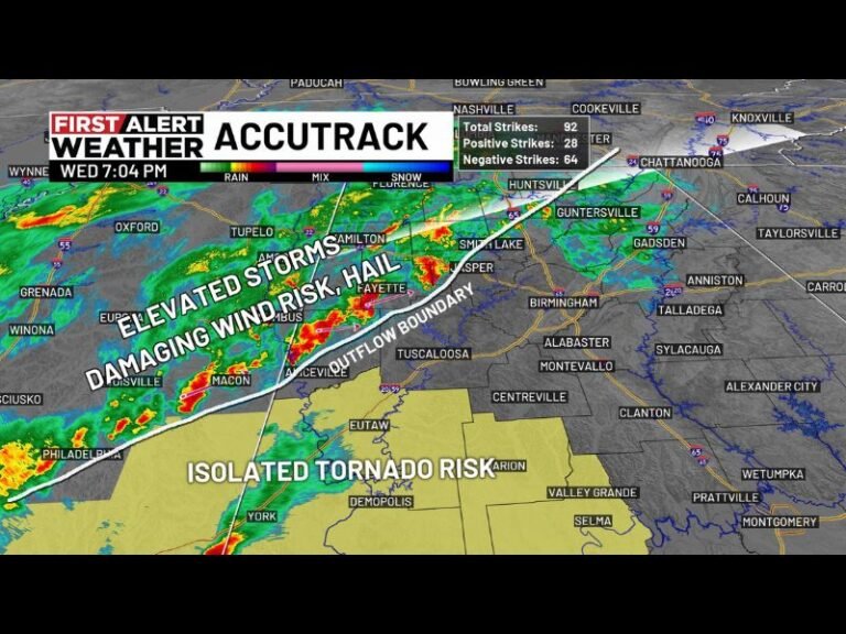
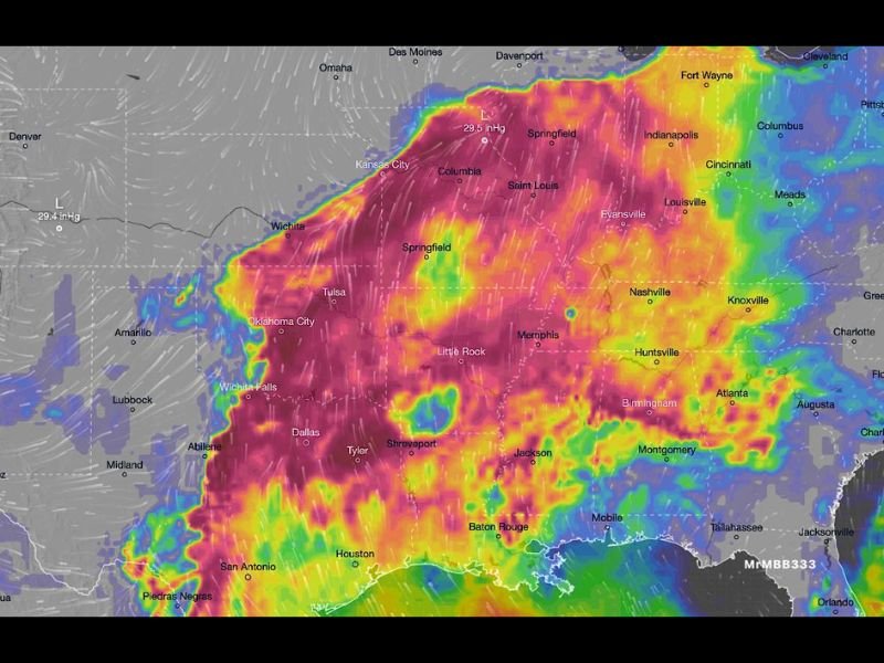
Meteorologists say the massive storm system stretches from Texas and Oklahoma through Arkansas and Missouri into Illinois, Indiana, Kentucky, Tennessee, and parts of the Southeast, creating one of the largest active severe weather corridors in recent weeks.
As storms begin to rapidly develop along this broad atmospheric boundary, forecasters warn that conditions are primed for multiple rounds of severe thunderstorms throughout the evening and overnight hours.
Atmosphere Primed for Major Storm Development
Weather models show a highly unstable atmosphere spreading across the central United States, allowing storms to intensify quickly once they begin forming.
The storm environment is capable of supporting:
- Large destructive hail
- Powerful straight-line winds
- Torrential rainfall
- Isolated to scattered tornadoes
The severe weather zone stretches across major population centers including Dallas, Oklahoma City, Little Rock, Memphis, St. Louis, Indianapolis, Louisville, Nashville, and Birmingham, placing millions of residents within the broader storm threat area.
Storm Corridor Spans Multiple Regions
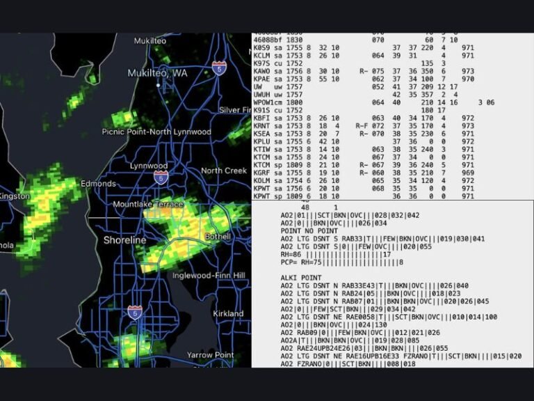
Radar projections and atmospheric analysis show the active storm corridor extending across a large portion of the central and eastern United States.
Key regions currently inside the severe weather zone include:
- North Texas and Oklahoma
- Arkansas and Louisiana
- Missouri and Illinois
- Indiana and Kentucky
- Tennessee and parts of Alabama and Georgia
Within this corridor, clusters of thunderstorms may evolve into long-lived storm lines and rotating supercells, capable of producing significant severe weather.
Millions in the Path of Developing Storms
Because the storm zone stretches nearly 2,000 miles across the country, millions of Americans are currently located within the broader risk area.
Forecasters say storms will likely continue developing and intensifying through the evening hours, with some areas experiencing multiple rounds of thunderstorms. The widespread nature of the system means severe weather reports could emerge from several states simultaneously as the storms track eastward overnight.
Residents Urged to Prepare for Severe Weather
Meteorologists urge people living inside the storm zone to remain alert and prepared in case warnings are issued.
Safety recommendations include:
- Monitoring local weather alerts and warnings
- Charging phones and enabling emergency alerts
- Moving vehicles under cover to protect from large hail
- Identifying the safest location in the home for shelter
- Being prepared to move quickly if a tornado warning is issued
Officials stress that severe storms can intensify rapidly, especially in environments capable of producing tornadoes.
Storm System Expected to Continue Developing
Forecasters say the severe weather outbreak may continue evolving throughout the night as the system pushes eastward across the country.
Because conditions remain favorable for strong thunderstorms, meteorologists are closely monitoring the situation for additional severe weather warnings and possible tornado development. Stay with SaludaStandard-Sentinel.com for continuing updates as this widespread severe weather event unfolds across the United States tonight.