Long-Range Models Suggest Possible Late-January Winter Storm Threat for Texas, Mississippi, Alabama, Georgia, and the Carolinas
SOUTHERN UNITED STATES — Early long-range weather models are catching attention across the South after new projections showed a potential late-January winter storm setup stretching from Texas across Mississippi, Alabama, Georgia, and into the Carolinas. While the outlook is not a formal forecast, meteorologists say the pattern resembles previous winter events that brought significant snow and ice to southern states.
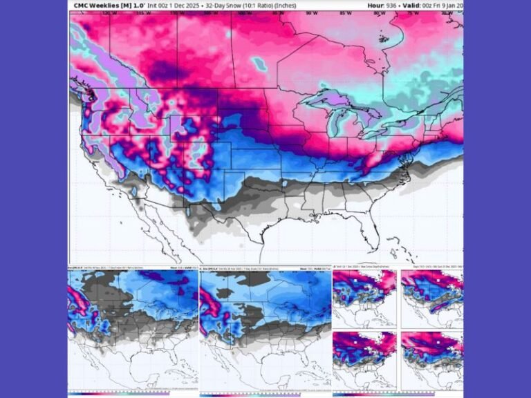
Model Signals Show Broad Snow Potential
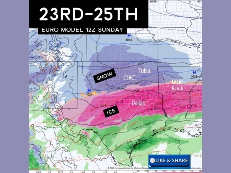
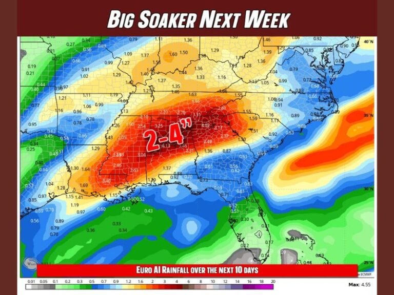
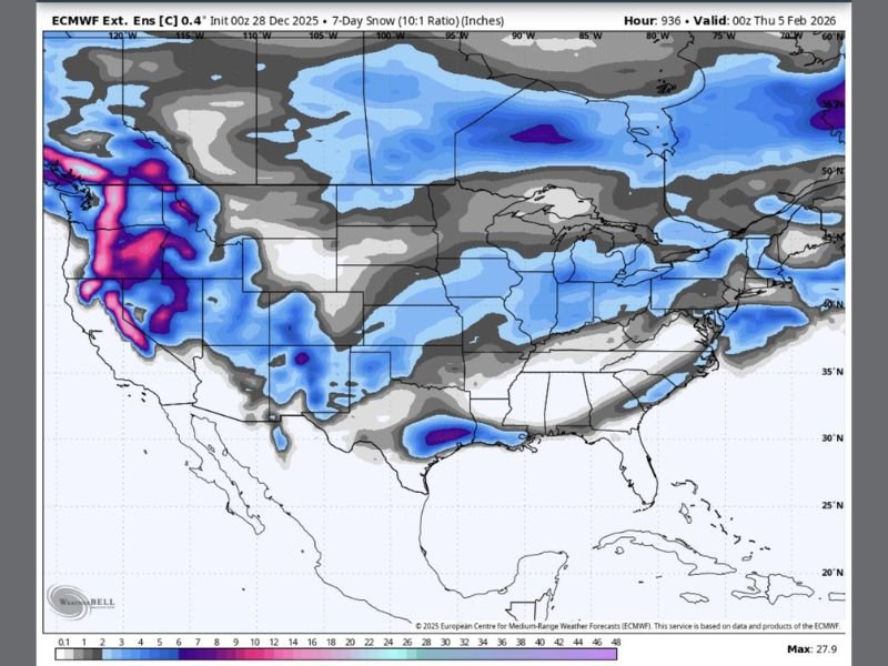
The latest extended European model (ECMWF) highlights a corridor of possible snowfall extending across much of the southern tier of the country. Though confidence remains low at this range, the model depicts accumulating snow potential from Texas through the Deep South and into the Mid-Atlantic.
Meteorologists emphasize that long-range guidance often shifts significantly, but the pattern itself is notable, especially for southern regions that rarely see impactful winter storms.
Pattern Resembles Past Southern Snow and Ice Events
Early signs indicate a setup similar to previous years when the South experienced disruptive winter weather. Historically, patterns like this have triggered:
- Sudden increases in grocery demand, especially milk and bread
- Rapid drops in temperatures affecting pipes
- Early school cancellations or delays
- Unexpected snow sticking despite forecasts of minimal accumulation
Climatologists note that the combination of southern moisture, a strong trough dipping into the Gulf states, and available cold air could create conditions favorable for winter weather if the pattern persists.
Southern States Already Paying Attention
Residents across Texas, Mississippi, Alabama, Georgia, and the Carolinas have begun reacting on social media, recalling memorable ice storms and rare snowfall events. Although it is far too early to confirm any specific track or impacts, the model output alone has prompted heightened awareness.
Meteorologists stress that this is a long-range signal, not an official forecast, but the atmospheric pattern showing up in late-January modeling is worth monitoring due to its consistency.
Next Updates Will Determine Credibility of the Signal
Over the coming days, meteorologists will watch for:
- Model agreement between ECMWF, GFS, and Canadian runs
- Whether cold air remains in place across the South
- The evolution of the upper-level trough over the central U.S.
If multiple model systems continue signaling the same outcome, the likelihood of a meaningful winter storm will increase. Residents are encouraged to follow updates closely as timing, intensity, and snowfall potential become clearer. For continuing national and regional weather coverage, visit SaludaStandard-Sentinel.com.