Late-Day Snow Models Split for South Carolina, Georgia, North Carolina and Florida as Sunday Storm Track Shifts Northward
SOUTH CAROLINA — A late-day shift in high-resolution guidance has added fresh uncertainty to the developing snow forecast for the Upstate and surrounding regions. One of the more reliable high-resolution models has moved the snow band farther north and west, raising the possibility of 1–2 inches in parts of the southern Upstate if that solution verifies.
NAM Shows a Northward Shift — But HRRR Shows Almost No Snow
Tonight’s late-day update shows the NAM model trending toward a noticeably farther north and west snow track. This would place accumulating snow across portions of the southern Upstate, making it a scenario worth noting.
However, at the same time, the HRRR model shows little to no snow, keeping temperatures just warm enough for mainly light rain instead of snow. This split highlights how sensitive the setup is to small-scale atmospheric features.
GFS and Euro Stay More Consistent — Light Snow Near Upstate, Better Chances Over Midlands
The GFS and European models remain generally consistent with earlier runs. Both continue to suggest light snow near the Upstate, but still place the better snow chances over the Midlands, where totals appear closer to an inch or less.
Because the storm system is interacting with narrow temperature gradients and small-scale atmospheric waves, confidence is still not locked in.
Why Confidence Remains Low — Small-Scale Features Driving Model Shifts
Forecasters emphasize that tonight’s conflicting signals are a classic example of small-scale features that different high-resolution models interpret differently. These subtle details often create last-minute shifts in track, temperature and precipitation type.
This is also why confidence has remained moderate to low, despite several days of monitoring. The forecaster notes there is still a better chance for a lower-end system farther south, but additional shifts remain possible.
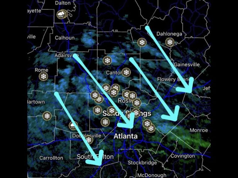
Snow Not Off the Table — NAM Graphic Highlights Potential Band
The NAM graphic included shows a defined precipitation shield stretching from the Gulf Coast through Georgia and the Carolinas, with a cold-side snow band positioned north of the main rain axis. The caption — “Snow not off the table!” — reinforces that the setup remains fluid and evolving.
While no high-end event is indicated, the possibility for accumulating snow still exists depending on subtle changes in timing and temperature.
More Updates Expected as the Picture Sharpens
The forecast remains unsettled heading into the next model cycle, and additional clarity is expected as short-range data continues to refine the Sunday setup.
Residents across the Upstate, Midlands and surrounding regions should avoid locking in expectations just yet — and wait for confidence to increase before planning around potential impacts.
More updates will be provided as new guidance arrives. Readers can follow developments or share local observations at SaludaStandard-Sentinel.com.