Kentucky, Tennessee and Carolinas Could See Dangerous Sunday Night Storm Line With Damaging Winds and Tornado Threat
KENTUCKY, TENNESSEE AND THE CAROLINAS — Forecasters are closely monitoring a developing line of severe thunderstorms expected to push east across the Southeast Sunday evening, potentially bringing damaging winds and isolated tornadoes to parts of Kentucky, Tennessee, North Carolina, and South Carolina.
Weather models show a long, organized line of storms forming to the west and moving rapidly toward the Appalachian region during the evening hours. As the system advances eastward, communities across multiple states could experience intense thunderstorms capable of producing strong wind gusts and dangerous lightning.
Storm Line Expected to Strengthen Sunday Evening
Latest forecast guidance suggests the storm line could begin intensifying across portions of western Kentucky and Tennessee during the late afternoon and early evening hours.
By around 7 p.m. Eastern Time, thunderstorms may begin approaching eastern Tennessee and parts of western Kentucky, with the potential for strong storm cells embedded within the line. These storms could quickly grow into a more organized structure capable of producing damaging straight-line winds.
Meteorologists say that as the storms move toward the Appalachian Mountains, they could maintain strength due to the warm and unstable air already present across the Southeast.
Storms Moving Into Appalachia Around 8 p.m.
Model projections show the line continuing eastward and approaching areas along the Tennessee–North Carolina border around 8 p.m. Eastern Time.
At this stage, storms could become more widespread and potentially stronger as they encounter increased atmospheric instability. This environment may support rotating thunderstorms capable of producing isolated tornadoes.
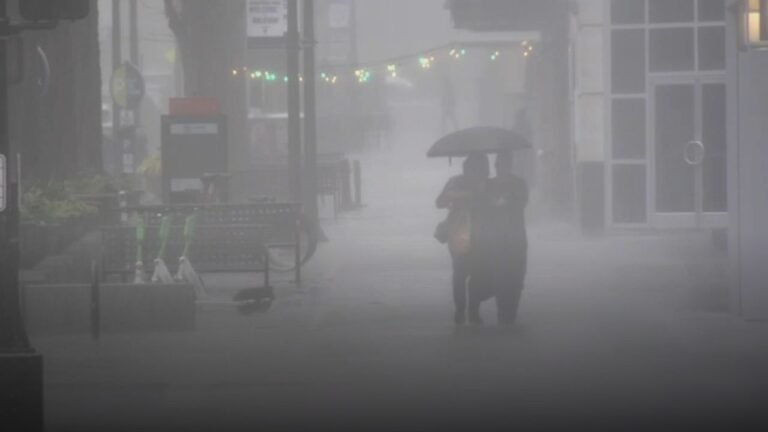
Communities across western North Carolina and nearby mountain regions could begin seeing heavy rainfall, strong wind gusts, and frequent lightning during this time frame. Residents in cities such as Asheville and surrounding communities should remain weather aware as storms approach.
Strong Storm Line Pushing Across the Carolinas Late Evening
By 10 p.m. Eastern Time, the storm line could extend from the Appalachian region into parts of western and central North Carolina. Forecast maps suggest a continuous band of thunderstorms pushing steadily eastward.
Storms embedded within this line could produce strong straight-line wind gusts capable of downing trees and power lines. Some storms may also produce localized tornadoes, especially if individual cells develop within the broader line. As the system continues moving east, it may gradually approach central parts of North Carolina and northern South Carolina late Sunday night.
Late Night Storm Threat Continues Toward Midnight
Forecast projections indicate the storm line may still be active near 11 p.m. Eastern Time, with storms continuing to track eastward through portions of the Carolinas.
Even though storms may gradually weaken overnight, strong winds and heavy rain could still impact communities across the region. Localized flooding in low-lying areas may also be possible if heavy rainfall develops within the strongest storm clusters.
Meteorologists emphasize that severe storms after dark can be particularly dangerous because many people may be asleep when warnings are issued. Residents are encouraged to keep mobile alerts enabled and ensure they have multiple ways to receive emergency weather notifications.
Residents Urged to Stay Alert for Rapid Weather Changes
With storms expected to develop quickly and move across multiple states during the evening hours, forecasters are urging residents to remain weather aware and monitor updates from local authorities.
Severe thunderstorms can intensify rapidly, and warnings may be issued with little notice if storms begin producing damaging winds or tornadoes. Emergency management officials recommend identifying safe shelter areas inside homes and staying prepared in case severe weather warnings are issued during the evening hours.
If severe weather develops in your area Sunday night, share updates and local conditions with the newsroom at SaludaStandard-Sentinel.com so others across the region can stay informed.