Jet Stream Dip Brings Freezing Temperatures to Florida as Northern States See Warmer Air Shift
TAMPA, Fla. — A dramatic shift in the jet stream has flipped weather patterns across North America this week, sending unseasonably cold air into the South while pushing mild temperatures north into parts of Canada.
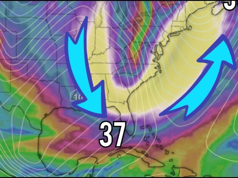
As of early Tuesday morning, Tampa recorded a low of 37°F, one of its coldest early-season readings in years — while Halifax, Nova Scotia, sat at a comparatively balmy 56°F. Meteorologists say this reversal is being driven by a pronounced dip in the jet stream, pulling Arctic air southward across the central and eastern United States.
Arctic Air Dips South, Bringing Frost and Snow
According to the National Weather Service (NWS), the jet stream — a fast-flowing air current that separates warm and cold air masses — has taken a sharp southward plunge this week, allowing cold Canadian air to spill deep into the Southeast.
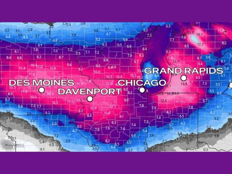
The result: widespread frost, chilly winds, and even light snow showers across parts of the lower Midwest and interior South. In northern Florida and southern Georgia, overnight lows dipped into the upper 30s, triggering freeze advisories for rural inland areas.
Meteorologist Dr. Ryan Maue described the setup as a “classic early winter pattern flip,” explaining, “When the jet dips this dramatically, we see a complete rearrangement of temperatures across the continent — cold in the South, warm up north.”
Florida Feels the Chill as Northern Regions Warm
While much of Florida shivered through its first real cold snap of the season, residents farther north in New England and Atlantic Canada experienced mild, spring-like air.
In Halifax, Nova Scotia, morning readings hovered in the mid-50s — nearly 20 degrees warmer than Tampa. The unusual contrast left many weather enthusiasts joking online about swapping climates for the week.
“I can’t believe I’m saying this, but Halifax feels more like Florida right now,” one social media user commented under a regional weather post.
Jet Stream Expected to Gradually Lift by Late Week
Forecasters say the cold blast will linger through midweek before the jet stream begins to retreat northward. Temperatures are expected to rebound slowly across Florida and the Southeast by the weekend.
Meanwhile, the upper Midwest and Northeast — currently basking in above-average warmth — will likely see their own cooldown by late week as the jet realigns into a more typical November pattern.
What’s Behind This Pattern Flip?
The weather anomaly stems from a blocking ridge of high pressure over the western Atlantic, which forced the jet stream to buckle dramatically. When that happens, Arctic air gets pulled southward on one side, while warmer air is pushed northward on the other — often leading to wild temperature contrasts.
“This kind of setup is common in transitional months like November,” said NWS meteorologist Alex Duncan. “But seeing such a strong contrast — 37°F in Tampa versus 56°F in Nova Scotia — really underscores how powerful these atmospheric shifts can be.”
Looking Ahead
The next few days will bring widespread frost risks across the Deep South, while the North experiences mild, occasionally rainy conditions. By early next week, forecasters expect more balanced temperatures nationwide as the jet stream returns to a flatter flow.
Residents in Florida and Georgia are advised to protect outdoor plants and pets from the chill and keep an eye on local forecasts for potential freeze warnings overnight.
For continuous updates on major weather changes across the U.S., visit SaludaStandard-Sentinel.com.