Indiana Weather Alert: Gusts Up to 50 MPH Expected Thursday as Strong Winds Sweep Across the State
INDIANA — Residents across Indiana are being warned to prepare for strong, gusty winds beginning Thursday morning, with the potential for widespread gusts reaching 40 to 50 mph across the state. Forecasters say the blustery conditions could continue into Friday, bringing the risk of isolated power outages, falling tree limbs, and travel disruptions.
According to the Indiana Weather Network, the northern half of the state — including Indianapolis, Lafayette, Muncie, Fort Wayne, and South Bend — will see the strongest gusts during the late morning and early afternoon hours on December 18, 2025.
Winds to Peak at 50 MPH in Northern Indiana
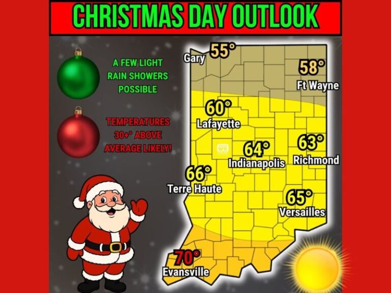
Meteorologists forecast that northern and central Indiana will experience gusts up to 50 mph, while areas farther south — including Bloomington, Evansville, and New Albany — may see gusts closer to 40 mph.
The strongest winds are expected to occur between 10 a.m. and 4 p.m. Thursday, shifting direction from southwest in the morning to west-northwest by afternoon as a strong cold front moves through the region.
“We’re looking at a classic setup for strong, non-thunderstorm wind gusts,” said one forecaster. “Even though there’s no severe storm activity expected, the combination of pressure gradients and cold air advection will make for a windy day across Indiana.”
Potential Impacts and Safety Concerns
Forecasters are urging Hoosiers to secure loose outdoor items such as holiday decorations, garbage bins, and patio furniture before the winds increase.
Officials also warn that tree limbs could snap, and scattered power outages may occur, particularly in the northern parts of the state where gusts will be strongest.
Key safety reminders from the Indiana Weather Network include:
- Avoid parking under trees or near power lines.
- Keep extra batteries and flashlights handy in case of power loss.
- Exercise caution when driving, especially for high-profile vehicles on open highways.
Cold Air to Follow Behind the Winds
The blustery conditions will usher in colder air by Thursday night, dropping temperatures from the 40s into the upper 20s and low 30s statewide.
Wind chills are expected to fall into the teens overnight, making it feel significantly colder by Friday morning.
By early Friday, winds should gradually weaken, though breezy conditions will linger as Indiana settles into a cooler, drier pattern for the weekend.
Forecast Overview
- Peak Gusts: 50 mph north, 40 mph south
- Timing: Thursday morning through Thursday night
- Primary Impacts: Power outages, tree damage, hazardous driving
- Wind Direction: Southwest shifting west-northwest by afternoon
Residents are advised to stay informed through local updates and prepare for potentially disruptive winds as this powerful weather system passes through.
Stay updated with statewide weather alerts and safety advisories at SaludaStandard-Sentinel.com.