Illinois and Wisconsin Weather Shift Brings Warmer Temperatures With Repeated Rain Chances and Possible Strong Storms Early Next Week
ILLINOIS AND WISCONSIN — A noticeable shift in the weather pattern is underway across northern Illinois and southern Wisconsin, with springlike warmth returning alongside a more active and wetter forecast beginning Wednesday.
After a stretch of cooler conditions, temperatures are set to rise steadily, but the warming trend will come with frequent chances for rain and increasing storm potential into early next week.
Warmer Temperatures Return Midweek
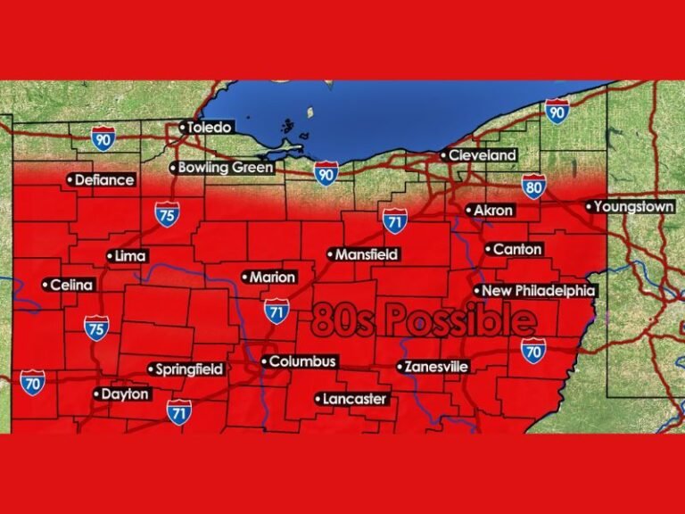
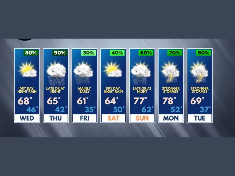
Beginning Wednesday, temperatures will climb into the upper 60s across much of the region, signaling a transition back to more typical spring conditions.
This warming trend will continue through the weekend, with highs pushing into the upper 70s by Sunday and Monday in some areas. Overnight lows will also trend milder, reinforcing the shift away from the recent chilly pattern. The return of warmer air will play a key role in supporting more active weather conditions moving forward.
Rain Chances Increase With Active Pattern
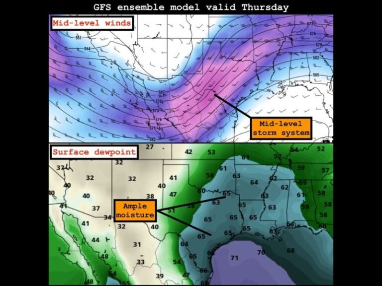
As temperatures rise, so will the chances for precipitation. Rain is expected to develop in multiple waves rather than a single prolonged event.
The highest chances for rain appear to be Wednesday night, again late Thursday into Thursday night, early Friday, and then once more Saturday night. This pattern suggests intermittent showers, with plenty of dry hours between systems rather than continuous rainfall.
No All-Day Washouts Expected
Despite the increased rain chances, current forecasts do not indicate widespread all-day or all-night washouts. Instead, rainfall will be scattered and periodic.
This means outdoor plans may still be possible between rain events, though flexibility will be important as conditions shift throughout the day. The stop-and-go nature of precipitation will help limit flooding concerns while still contributing to overall rainfall totals.
Thunderstorm Chances Return Late Weekend
Thunderstorm chances are expected to return to the forecast beginning late Sunday or Sunday night, with additional opportunities continuing into Monday and Tuesday.
While details remain uncertain, there are early indications that some storms during this period could become stronger. However, forecasters emphasize that it is still too early to determine the extent or severity of any potential storm activity.
Early Next Week Could Bring Stronger Storm Signals
The period from Sunday through Tuesday will be closely monitored as the pattern evolves. Subtle signals in the data suggest the potential for stronger storms, though confidence remains low at this stage.
With several days still to go, changes in timing, intensity, and location are likely as more data becomes available. Residents are encouraged to stay updated as this portion of the forecast becomes clearer.
A Classic Spring Pattern Taking Shape
Overall, this forecast reflects a classic spring transition pattern, combining warmer temperatures with frequent rain and increasing storm chances.
While no major severe weather threats are currently expected, the evolving setup points toward a more dynamic weather period across Illinois and Wisconsin.
Residents should prepare for changing conditions, fluctuating temperatures, and periodic rainfall as the week progresses. How are you planning around the changing spring weather this week? Share your thoughts and local conditions with us at SaludaStandard-Sentinel.com.